


CANAMEK XT GPS Auto Steering System for Tractors


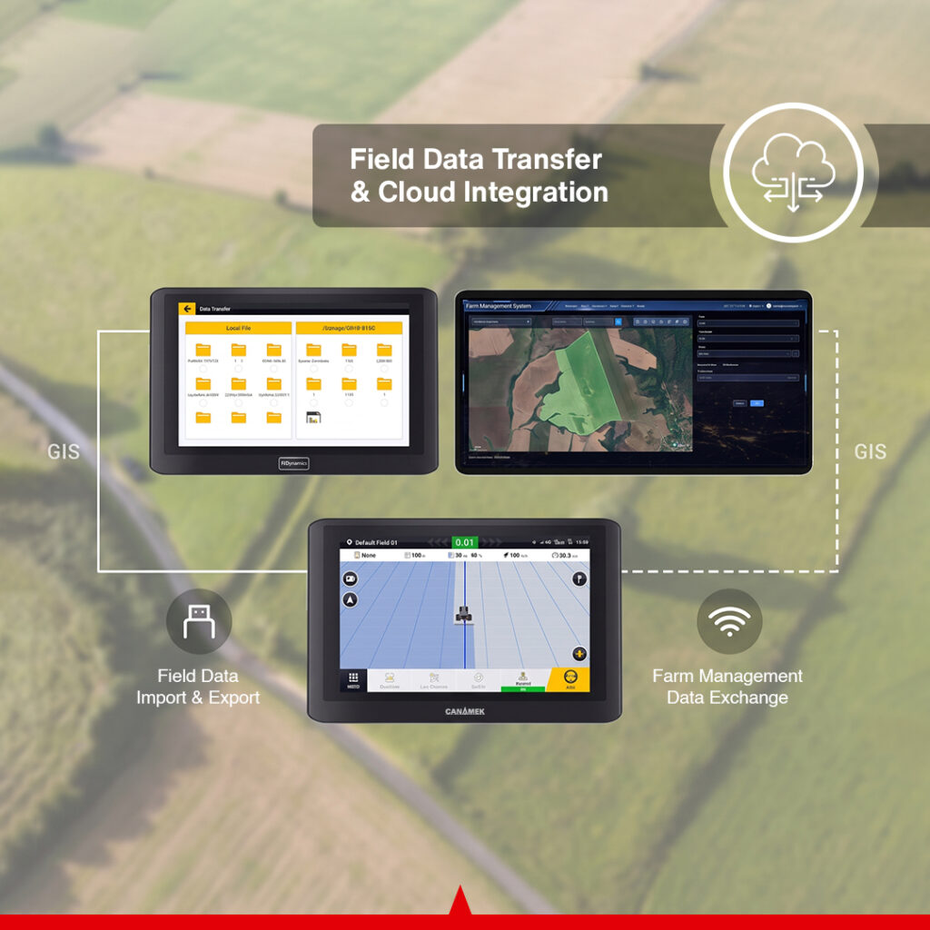
Free shipping Ships in 24h
2-year warranty Extend to 5
6-month CORS Network Subscription included
Pro install Available add-on
Highlights
Full SpecsAn electric GPS auto steering system for tractors combining GNSS positioning, RTK guidance and terrain compensation for planting, crop care and harvesting with compatible machinery.
- RTK steering accuracy of up to ±0.98 in / ±2.5 cm with suitable corrections and proper calibration.
- Operating speed range of 0.06–16.16 mph / 0.1–26 km/h for slow and faster field operations.
- 10.1 in touchscreen with 1280 × 800-pixel resolution.
- One GNSS receiver with an integrated IMU for vehicle attitude and terrain compensation.
- Optional automatic U-turn with a lifetime license, plus an included one-year free cloud-platform trial.
- 2-Year Free Warranty
- After-Sales Support, 7 Days a Week
01 Product information
 CANAMEK XT GPS Auto Steering System for Tractors CNMK-ASS-1046
Description
Overview
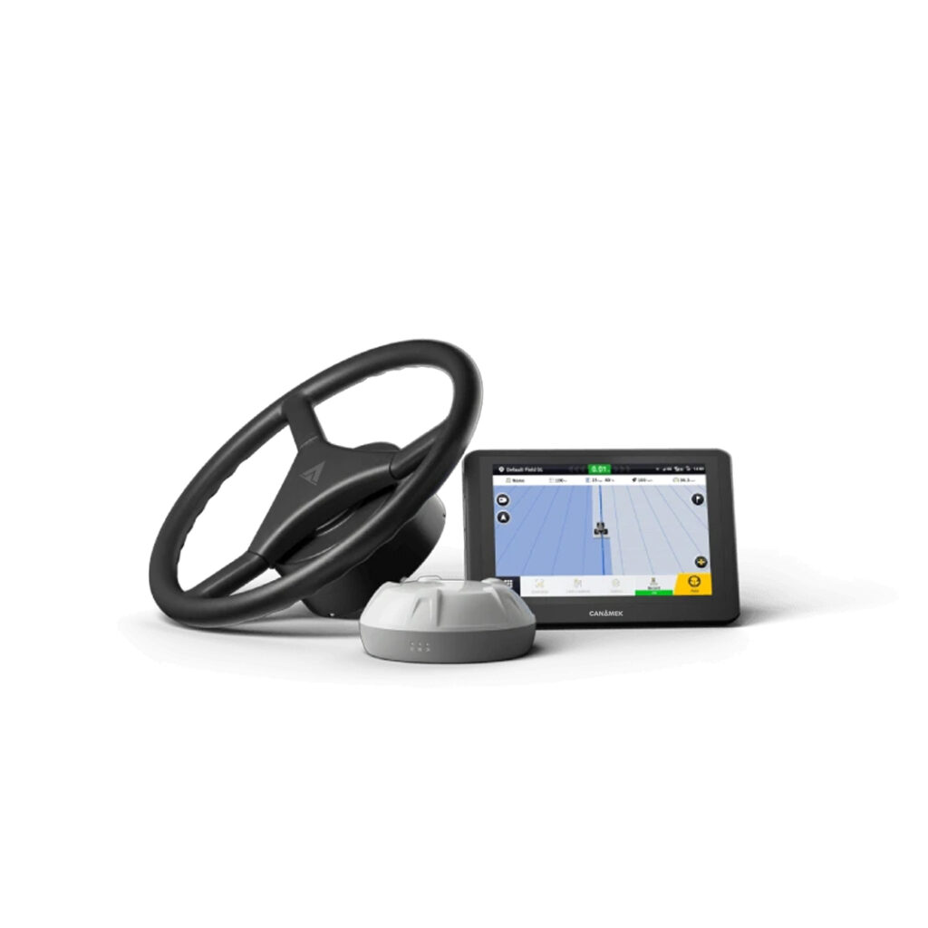
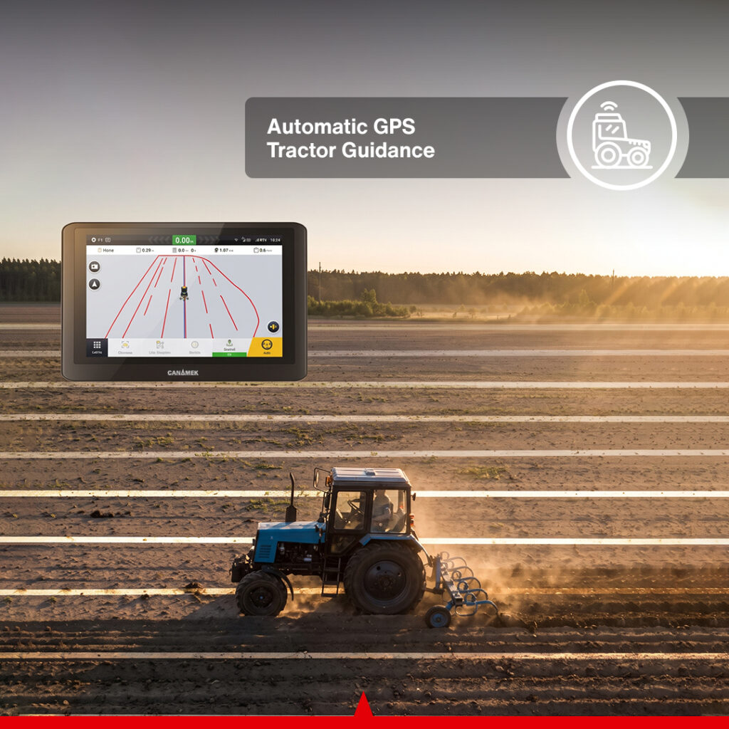
The CANAMEK XT Auto Steering System is a GPS auto steering system for tractors that uses satellite positioning and an electric steering wheel to follow planned field routes. Its control terminal combines guidance, vehicle settings and field information in the cab, while the GNSS receiver supplies position and attitude data for steering control.
XT is intended for compatible agricultural machinery used in land preparation, planting, spraying, fertilizing and harvesting. It provides a retrofit approach to automatic steering through a motor-driven steering wheel, with installation hardware selected for the machine. This arrangement does not require a direct connection to the tractor’s hydraulic steering circuit.
With suitable RTK corrections and proper calibration, the system supports steering accuracy of up to ±0.98 in / ±2.5 cm. Terrain compensation accounts for vehicle tilt, while different guidance patterns let the operator plan passes around the field’s shape and the work being performed. The operator remains responsible for supervising the machine and managing the operation.
The standard steering package includes a one-year free cloud-platform trial for supported field and operational data exchange. It can be expanded with a compatible RTK base station and automatic U-turn through an optional lifetime Smart U-turn license. CANAMEK provides a 2-Year Free Warranty for the complete XT package, including supplied accessories, together with After-Sales Support, 7 Days a Week.
Complete Tractor Guidance and Auto Steering Workflow
XT connects machine setup, correction reception, guidance planning and steering in one operating workflow:
- Install and calibrate the system. Fit the steering wheel, terminal, GNSS receiver, sensor and wiring using hardware appropriate to the tractor. Complete the required vehicle and steering calibration before field operation.
- Connect a correction source. Use a compatible network RTK service through NTRIP or a separately purchased base station for RTK operation. Select an available PPP or SBAS service when its positioning performance suits the task.
- Prepare the guidance route. Choose a straight, curved, A+ or pivot line, use supported field-boundary guidance, or load compatible field and guidance data.
- Engage automatic steering. The system uses positioning and vehicle information to operate the electric steering wheel along the selected route. Monitor the machine, implement and guidance display throughout the pass.
- Manage the headland. With the optional lifetime Smart U-turn license activated, use automatic U-turn and the planned headland-closing function where appropriate. The operator must supervise the tractor and implement throughout the maneuver.
- Retain useful field information. Save completed routes as line groups and transfer supported field information for later operations or use on compatible systems. The included one-year free cloud-platform trial supports connected field-data exchange with an appropriate internet connection.
Configure XT for Your Tractor and Correction Source
Standard Auto Steering Package
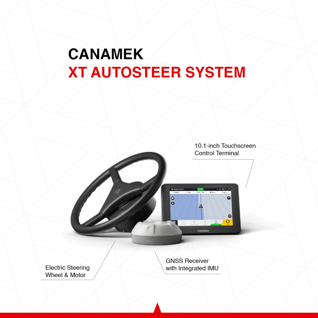
The package combines the hardware required for the XT steering installation and includes a one-year free cloud-platform trial. Machine-specific adapters and brackets must match the tractor being equipped.
| Included component or service | Purpose |
|---|---|
| Control terminal and mounting hardware | Guidance display, system setup and operator controls |
| Electric steering wheel and steering motor | Automatic operation of the tractor’s steering through its steering column |
| One GNSS receiver with integrated IMU | Satellite positioning and vehicle attitude information |
| Wheel-angle/attitude sensor | Steering feedback for the configured installation |
| Radio and cellular communication components | Connections used by the supplied correction and communication configuration |
| Power, receiver, sensor and terminal wiring | Connections between the installed components |
| Required installation accessories | Hardware selected for the compatible machine |
| One-year free cloud-platform trial | Access to supported field and operational data exchange during the trial period |
Network RTK Through NTRIP
Where a suitable correction network is available, XT can receive RTK corrections through an NTRIP service. This avoids setting up a separate local base station for that correction arrangement. Network coverage, an appropriate data connection and access to the selected correction service are required.
NTRIP charges are set by the provider. Availability and pricing must be checked for the operating region; a correction service should not be assumed to be included with the steering hardware.
Optional Local RTK Base Station
A compatible local base station is a separate purchase. It provides an alternative RTK correction source where the farm prefers a local reference or suitable network RTK is unavailable. The base station and tractor equipment must use a compatible correction configuration and radio arrangement.
Optional Functions and Accessories
- Automatic U-turn with a lifetime Smart U-turn license: optional software for automatic headland turns and field-task planning.
- Wi-Fi camera: an optional live view of the implement or another selected area around the machine.
- Easy Control keypad: an optional physical control interface when touchscreen access is inconvenient.
- Easy Switch: an optional button or pedal interface for changing between manual and automatic steering.
The tractor, agricultural implement, RTK base station and these optional additions are not part of the standard steering package unless separately included in the order.
RTK Positioning for Consistent Field Passes
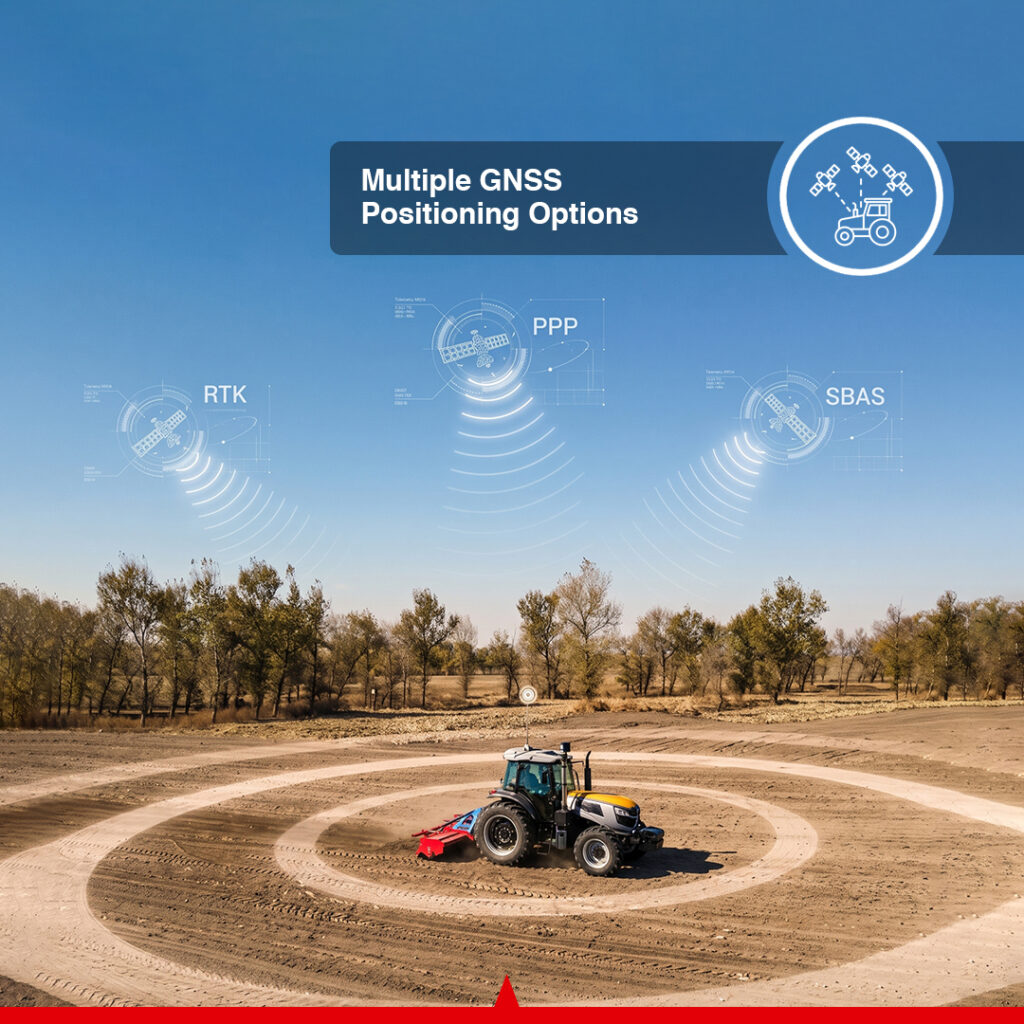
XT uses a multi-constellation GNSS receiver supporting GPS, GLONASS, BeiDou, Galileo and QZSS signals. For precision steering, RTK correction data works with the positioning system and calibrated machine settings to support the specified steering accuracy.
The ±0.98 in / ±2.5 cm figure applies to suitable RTK operation with correct installation and calibration. Satellite reception, correction availability and operating conditions affect the result. PPP and SBAS are additional positioning choices, with accuracy and availability determined by the selected service and working conditions.
This lets the correction arrangement follow the job: precision planting and repeatable passes can use RTK, while other supported positioning modes can be considered where their performance is appropriate.
Electric Steering Wheel Retrofit
The electric steering assembly replaces the existing steering wheel using the correct splined sleeve and mounting arrangement. The motor operates the steering column under guidance control, allowing compatible tractors to gain automatic steering through an electrical and mechanical installation.
The wheel measures 16.14 in / 410 mm in diameter. Maximum motor torque is 14.75 lb-ft / 20 N·m at 12 V and 22.13 lb-ft / 30 N·m at 24 V. These are motor torque ratings; tractor suitability also depends on steering condition, mounting compatibility and the completed calibration.
The retrofit must be selected for the machine’s make and model. Contact CANAMEK with the tractor details and intended implement to establish the appropriate installation hardware.
Terrain Compensation and Vehicle Attitude
An IMU integrated into the GNSS receiver provides vehicle attitude information, including pitch and roll. The guidance system uses this information for terrain compensation as the machine moves over sloping or uneven ground.
Compensating for tilt helps the steering system account for changes in the relationship between the roof-mounted receiver and the vehicle’s path. A separate wheel-angle/attitude sensor supports steering feedback in the installed configuration. These components serve different roles and should be installed and calibrated as specified.
Guidance Patterns for Different Field Shapes
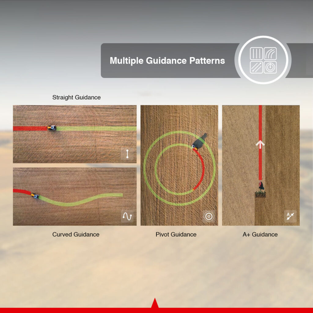
The operator can choose a route type around the field layout and operation:
| Guidance function | Application |
|---|---|
| Straight line | Repeated parallel passes across a field |
| Curved line | Following an established curved route |
| A+ line | Establishing a straight guidance direction from a point and heading |
| Pivot | Working along circular field routes |
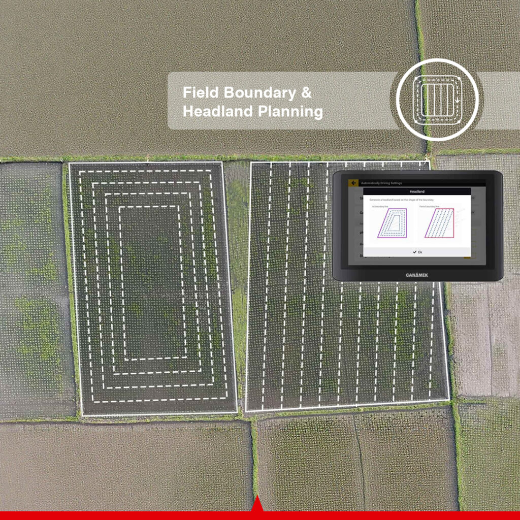
| Boundary-based guidance | Generating routes from an entire field boundary or selected boundary segments |
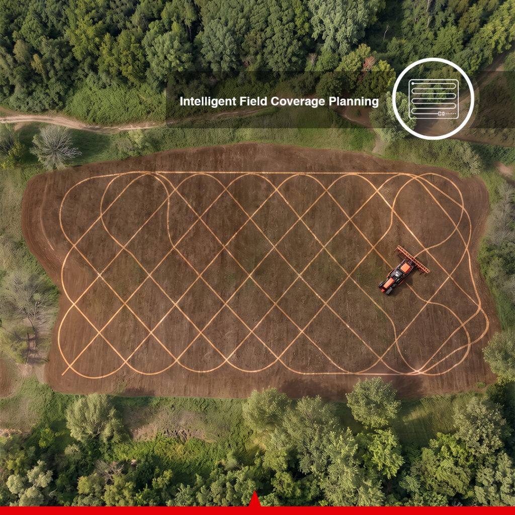
| Diagonal harrowing planning | Planning crossing passes for harrowing operations |
| Tramlines | Creating planned unplanted tracks for subsequent spraying access |
| Saved line groups | Reusing completed routes or exchanging compatible guidance information |
These functions provide alternatives to planning every job around a single straight-line pattern. Saved routes and compatible imports also help maintain continuity between field operations.
Automatic U-Turn with a Lifetime License
CANAMEK XT supports automatic U-turn through an optional lifetime Smart U-turn license, purchased separately from the standard steering package. Once activated, the function uses the field boundary to plan the task and guide automatic turns at the ends of field passes.
The planning function can skip previously worked areas and supports headland closing. Boundary warnings help the operator monitor the planned operation. The turning route must suit the tractor, implement and available working area, with the operator supervising the machine throughout the maneuver.
Reduce Overlap and Missed Strips
Manual steering requires the operator to judge the position of each new pass while also monitoring the implement. XT follows a selected guidance route and uses the configured working setup to organize field passes. This can help reduce unnecessary overlap and missed strips during planting, spraying, fertilizing and other compatible operations.
The practical result depends on correct implement settings, the correction source and field conditions.
Reduce Repetitive Steering Work
Automatic steering reduces the continuous wheel adjustments required to remain on a planned route. The operator can devote more attention to monitoring the implement and the progress of the field operation while continuing to supervise the tractor.
This is useful during repeated passes over larger areas and during slower operations where maintaining a steady route requires sustained attention. The published operating range is 0.06–16.16 mph / 0.1–26 km/h; the appropriate working speed remains determined by the tractor, implement and job.
Reuse Field Routes and Exchange Guidance Data
Completed paths can be saved as line groups for future use. Compatible routes can also be imported from other platforms or exported for another system, supporting planning before the machine enters the field.
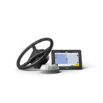
XT supports USB transfer of field information in supported standard GIS formats. Data compatibility depends on the file contents and the software used by the sending and receiving systems. Check the required format when exchanging boundaries or guidance lines with another platform.
Connectivity, Cloud Integration and Software Updates
The control terminal provides cellular connectivity, 2.4 GHz Wi-Fi, USB Type-C connections and a SIM-card interface. These connections support the applicable correction, data and online functions. Mobile-network operation requires suitable service coverage and a compatible data arrangement.
XT includes a one-year free cloud-platform trial. The connected platform supports exchange of field and operational data, including task information such as boundaries and guidance lines, linking field planning with work on the tractor.
Cloud functions require an appropriate internet connection. Continued cloud-service access after the trial is optional and subject to the applicable subscription terms. Contact CANAMEK for the current service arrangement and pricing. The optional automatic U-turn license is lifetime and is separate from the cloud trial.
Online support and over-the-air software updates are documented platform capabilities. They require the appropriate network connection and available support or update service for the installed system.
Solutions for Agricultural Tractor Guidance
XT supports steering throughout the agricultural season: seedbed preparation and harrowing, planting, crop protection, fertilizer application and harvesting with compatible equipment. Its speed range and route options allow the guidance setup to be adapted to the operation rather than requiring the same pattern for every field.
For agricultural contractors, compatible data exchange and reusable line groups help carry field information between supported systems and jobs. Machine suitability and implement settings should be established separately for each installation.
Ownership Benefits and CANAMEK Support
The XT package brings the control terminal, electric steering assembly, GNSS receiver, sensor, communication components and installation wiring together in one steering offering, with a one-year free cloud-platform trial included. Optional correction equipment and the lifetime Smart U-turn license for automatic headland turns can be selected around the machinery and work required.
CANAMEK provides a 2-Year Free Warranty covering the complete XT package, including supplied accessories, and After-Sales Support, 7 Days a Week. Assistance is available through CANAMEK Support & Service for setup questions, troubleshooting and service coordination.
Key Features at a Glance
- Electric steering-wheel retrofit for compatible agricultural machinery.
- RTK-assisted steering accuracy of up to ±0.98 in / ±2.5 cm with suitable corrections and calibration.
- Operating speed range of 0.06–16.16 mph / 0.1–26 km/h.
- One GNSS receiver with integrated IMU and terrain compensation.
- GPS, GLONASS, BeiDou, Galileo and QZSS signal support.
- RTK, PPP and SBAS positioning options, subject to service availability and conditions.
- 10.1 in touchscreen with 1280 × 800-pixel resolution.
- Straight, curved, A+, pivot, boundary-based and other documented planning functions.
- Saved guidance line groups and supported GIS data exchange by USB.
- Optional automatic U-turn with a lifetime Smart U-turn license for headland turns, task planning and headland closing.
- Cellular and Wi-Fi connectivity, cloud data-exchange capability and OTA updates.
- One-year free cloud-platform trial included; continued cloud access is subject to optional subscription terms.
- Optional camera, keypad and steering-engagement accessories.
- IP65 control terminal and steering assembly; IP66 GNSS receiver; IP67 attitude sensor.
- CANAMEK two-year package warranty and after-sales support seven days a week.
Why Choose the CANAMEK XT Auto Steering System?
XT combines the equipment needed to follow planned tractor routes with the guidance choices needed for different field layouts. Satellite positioning, attitude compensation and electric wheel control work together to reduce repetitive steering while keeping the operation under the driver’s supervision.
For growers, this provides a practical route to automatic steering on compatible machinery already used for planting, crop care and harvesting. For agricultural contractors, reusable guidance information and configurable correction arrangements support work across different fields and customers.
Compare the CANAMEK auto steering systems or request a machine-specific quotation to select the installation, correction source and optional functions required for the tractor.
Frequently Asked Questions
What is the CANAMEK XT Auto Steering System?
CANAMEK XT is a GPS auto steering system for tractors and compatible agricultural machinery. It combines a control terminal, electric steering wheel, GNSS receiver with integrated IMU and steering-feedback components to follow planned field routes.
What is included in the standard XT package?
The package includes the control terminal, electric steering wheel and motor, one GNSS receiver with integrated IMU, the wheel-angle/attitude sensor, communication components, wiring and installation accessories, plus a one-year free cloud-platform trial. The steering adapter and mounting hardware must be matched to the machine.
Is an RTK base station included?
No. A compatible RTK base station is a separate purchase. XT can also use a suitable network RTK service through NTRIP where the required coverage, data connection and service access are available.
Is the automatic U-turn license lifetime?
Yes. Automatic U-turn is available for CANAMEK XT through an optional lifetime Smart U-turn license, purchased separately from the standard steering package. Its lifetime term is separate from the included one-year cloud-platform trial.
How accurate is CANAMEK XT?
With suitable RTK corrections and proper installation and calibration, steering accuracy can reach up to ±0.98 in / ±2.5 cm. Reception, correction availability and operating conditions affect performance. That RTK figure should not be applied to PPP or SBAS operation.
What is the operating speed range?
The published operating range is approximately 0.06–16.16 mph / 0.1–26 km/h. Choose the actual working speed around the tractor, implement, field conditions and task.
Does XT steer automatically, and is an operator still required?
XT operates the electric steering wheel to follow the selected guidance route. An operator must supervise the tractor and implement, manage the operation and take manual control when required.
Does the system connect directly to the tractor’s hydraulics?
No direct hydraulic-circuit connection is required for this electric steering-wheel system. It operates through a compatible steering-column installation using the appropriate adapter, mounting hardware and calibration.
Can XT be installed on an older tractor?
XT can be installed on compatible older machinery, but suitability must be checked for the exact tractor. Provide CANAMEK with the make, model, steering arrangement and intended implement so the required mounting hardware and setup can be identified.
Can it be used on agricultural machinery other than tractors?
XT supports compatible agricultural machinery including harvesters, rice transplanters and plant-protection equipment. The correct steering installation, calibration and electrical configuration must be confirmed for each machine.
Which guidance patterns are available?
The system supports straight, curved, A+ and pivot guidance. Additional documented functions include boundary-based guidance, diagonal-harrowing planning, tramlines and reusable guidance line groups.
How does terrain compensation work?
The GNSS receiver contains an IMU that supplies vehicle attitude information, including pitch and roll. The system uses this information to compensate for tilt during guidance over sloping or uneven ground. Correct installation and calibration remain necessary.
Does XT support automatic U-turn?
Yes. With the optional lifetime Smart U-turn license activated, XT uses the field boundary to plan the task and guide automatic U-turns at the ends of field passes. It can skip previously worked areas during route planning, supports headland closing and provides boundary warnings. The operator must supervise the tractor and implement.
Can XT work without a local base station?
Yes. Suitable network RTK through NTRIP can provide corrections without a local base station. PPP and SBAS are additional positioning options where available, with different service requirements and performance from RTK.
Can it receive RTK corrections without mobile-network coverage?
A compatible local base station and matching radio configuration provide an alternative to network RTK. This arrangement requires suitable radio reception and satellite conditions. Internet-dependent cloud or support functions still need an appropriate connection.
Does the system support PPP and SBAS?
Yes. The manufacturer lists PPP and SBAS among the positioning options. Their accuracy and availability depend on the selected service and operating conditions; they do not automatically provide the stated RTK steering accuracy.
Can field boundaries and guidance lines be transferred?
Yes. The platform supports field-information transfer using USB and supported standard GIS formats. Saved guidance line groups can be reused or exchanged with compatible systems. Confirm compatibility for the files and software involved.
Is a cloud-platform trial included?
Yes. The standard XT package includes a one-year free cloud-platform trial for supported field and operational data exchange, including task information such as boundaries and guidance lines. Cloud functions require an appropriate internet connection.
What happens after the cloud trial ends?
Continued cloud-service access is optional and subject to the applicable subscription terms. Contact CANAMEK for current service options and pricing. The optional automatic U-turn license remains a separate lifetime license; its term is not limited to the cloud-trial period.
Which optional equipment and services are purchased separately?
The lifetime Smart U-turn license for automatic turns, RTK base station and other optional accessories are separate purchases. A one-year free cloud-platform trial is included. Continued cloud access after the trial, NTRIP and mobile data have their own service terms and potential charges; confirm the services required for the intended installation.
What electrical supply does XT require?
The electric steering wheel is specified for 12 V or 24 V. The control terminal and GNSS receiver each have a 9–36 V input rating. The external attitude sensor uses its specified 5 V system connection. Follow the supplied wiring instructions and individual component ratings.
What steering-wheel size and torque does the system use?
The wheel diameter is 16.14 in / 410 mm, and the assembly measures 16.14 × 16.14 × 5.31 in / 410 × 410 × 135 mm. Maximum torque is 14.75 lb-ft / 20 N·m at 12 V and 22.13 lb-ft / 30 N·m at 24 V.
What are the display specifications?
The control terminal has a 10.1 in capacitive touchscreen, 1280 × 800-pixel resolution, LED backlighting and 700-nit brightness, approximately 204.3 fL / 700 cd/m². It contains 2 GB RAM and 8 GB ROM.
What protection ratings and operating temperatures apply?
The control terminal and electric steering assembly are IP65, the GNSS receiver is IP66, and the external attitude sensor is IP67. The terminal and receiver operate from −4°F to 158°F / −20°C to 70°C. The sensor operates from −4°F to 185°F / −20°C to 85°C. These ratings apply to the named components.
Are software updates and online support available?
XT supports online assistance and over-the-air software updates with suitable connectivity and available services. CANAMEK also provides after-sales support seven days a week for the XT offering.
What warranty does CANAMEK provide?
CANAMEK provides a 2-Year Free Warranty for the complete XT package, including supplied accessories, and After-Sales Support, 7 Days a Week.
Technical specifications
Full data sheet
System and Steering Performance
| Specification | Value |
|---|---|
| Product | CANAMEK XT Auto Steering System |
| System type | GNSS-guided electric auto steering for compatible agricultural machinery |
| Steering actuator | Electric steering wheel and motor |
| RTK steering accuracy | Up to ±0.98 in / ±2.5 cm with suitable RTK corrections and proper calibration |
| Operating speed range | 0.06–16.16 mph / 0.1–26 km/h |
| Terrain compensation | Vehicle attitude compensation using the GNSS receiver's integrated IMU |
| GNSS receiver quantity | One |
| Positioning options | RTK, PPP and SBAS; service availability and operating conditions apply |
| Network correction option | NTRIP network RTK with suitable connectivity and service access |
| Local correction option | Compatible RTK base station, purchased separately |
| Steering wheel electrical supply | 12 V or 24 V |
| Direct hydraulic-circuit connection | Not required for the electric steering-wheel installation |
| Installation | Machine-specific steering-column adapter, brackets, wiring and calibration |
| Operation | Automatic steering with operator supervision and manual control available |
Control Terminal
| Specification | Value |
|---|---|
| Display size | 10.1 in |
| Touch interface | Capacitive touchscreen |
| Display resolution | 1280 × 800 pixels |
| Backlight | LED |
| Display brightness | 700 nits / 700 cd/m², approximately 204.3 fL |
| Dimensions | 10.83 × 7.09 × 1.57 in / 275 × 180 × 40 mm |
| Mass | Approximately 3.31 lb / 1.50 kg |
| Screen-to-body ratio | 0.73, equivalent to 73% |
| RAM | 2 GB |
| Internal storage | 8 GB ROM |
| Audio | Integrated speaker |
| Power input | 9–36 V |
| Mobile-network module | 4G, 3G and 2G; availability depends on regional hardware and networks |
| Wi-Fi band | 2.4 GHz |
| Wi-Fi frequency range, product-page specification | 2.4–2.5 GHz |
| Wi-Fi output level, published manufacturer notation | 14 dB ±1.5 dB |
| Main wiring-harness ports | 2 |
| Radio port | 1 |
| USB Type-C ports | 2 |
| SIM-card slot | 1; Micro-SIM specified in the hardware manual |
| Relative humidity | 0–95% at 104°F / 40°C, non-condensing |
| Operating temperature | −4°F to 158°F / −20°C to 70°C |
| Storage temperature | −40°F to 185°F / −40°C to 85°C |
| Ingress protection | IP65 |
GNSS Receiver and Integrated IMU
| Specification | Value |
|---|---|
| Receiver quantity | One |
| Dimensions | 6.38 × 2.54 in / 162 × 64.5 mm |
| GPS signals | L1C/A, L1C, L2P(W), L2C, L5 |
| GLONASS signals | L1, L2 |
| BeiDou signals | B1I, B2I, B3I, B1C, B2a |
| Galileo signals | E1, E5a, E5b |
| QZSS signals | L1, L2, L5 |
| Listed SBAS services | WAAS, EGNOS, MSAS |
| Power input | 9–36 V |
| Operating current | Less than 300 mA |
| IMU | Integrated in the GNSS receiver |
| Accelerometer accuracy | 0.5 mg, where mg means milligravity; approximately 0.0161 ft/s² / 0.00490 m/s² |
| Gyroscope accuracy | 0.1°/s |
| Roll/pitch specification | 0.2° |
| Operating temperature | −4°F to 158°F / −20°C to 70°C |
| Storage temperature | −40°F to 185°F / −40°C to 85°C |
| Ingress protection | IP66 |
IMU component figures describe the attitude-sensing hardware. The system's RTK steering accuracy is the separate performance specification given above.
Electric Steering Wheel and Motor
| Specification | Value |
|---|---|
| Steering wheel diameter | 16.14 in / 410 mm |
| Assembly dimensions | 16.14 × 16.14 × 5.31 in / 410 × 410 × 135 mm |
| Supply voltage | 12 V or 24 V |
| Maximum torque at 12 V | 14.75 lb-ft / 20 N·m |
| Maximum torque at 24 V | 22.13 lb-ft / 30 N·m |
| Ingress protection | IP65 |
| Steering-column interface | Splined sleeve selected for the machine |
| Mounting | Machine-specific steering motor bracket and associated hardware |
External Attitude / Wheel-Angle Sensor
| Specification | Value |
|---|---|
| Function | Steering feedback for the configured machine installation |
| Sensor supply | 5 V through the specified system connection |
| Maximum output frequency | 200 Hz |
| Resolution | Less than 0.1° |
| Operating temperature | −4°F to 185°F / −20°C to 85°C |
| Ingress protection | IP67 |
Radio Antenna and Cellular Connection
The following radio antenna figures describe the regional versions documented for the system. The installed radio, antenna and correction source must match; the two bands are not a simultaneous dual-band specification.
| Specification | Value |
|---|---|
| Documented radio antenna frequency versions | 410–470 MHz or 902–928 MHz |
| Voltage standing wave ratio | ≤2.0 |
| Antenna gain, published manufacturer notation | >1 ±0.5 dBi |
| Impedance | 50 Ω |
| Polarization | Vertical |
| Documented antenna dimensions | Ø3.23 × 19.29 in / Ø82 × 490 mm, or Ø3.23 × 11.85 in / Ø82 × 301 mm |
| Antenna operating temperature | −4°F to 140°F / −20°C to 60°C |
| SIM format | Micro-SIM |
| LTE-FDD bands documented in the hardware manual | B1, B2, B3, B4, B5, B7, B8, B12, B13, B18, B19, B20, B25, B26, B28 |
| LTE-TDD bands documented in the hardware manual | B38, B39, B40, B41 |
| UMTS bands documented in the hardware manual | B1, B2, B4, B5, B6, B8, B19 |
| GSM bands documented in the hardware manual | B2, B3, B5, B8 |
| Cellular service requirement | Compatible SIM/data service and available network coverage |
Wiring and Installation Hardware
| Item | Specification / function |
|---|---|
| Power wiring harness | Machine battery connection to the system |
| GNSS receiver wiring harness | Receiver-to-system connection |
| Main wiring harness | Primary terminal/system connections |
| Spare main wiring harness | Additional harness identified in the manufacturer packing list |
| Attitude sensor wiring harness | External sensor connection |
| Control terminal mount | Bracket and mounting base |
| GNSS receiver mount | Receiver bracket and fixing hardware |
| Steering adapter and motor bracket | Selected to match the tractor's steering column and mounting arrangement |
| Sensor bracket | Selected for the machine installation |
| Radio antenna mounting | Antenna base and appropriate fixing arrangement |
Guidance, Planning and Data Functions
| Function | Availability / scope |
|---|---|
| Straight-line guidance | Supported |
| Curved-line guidance | Supported |
| A+ guidance | Supported |
| Pivot guidance | Supported |
| Boundary-based guidance | Entire boundary or selected boundary segments |
| Diagonal harrowing planning | Supported |
| Tramlines | Planned unplanted tracks for subsequent spraying operations |
| Guidance line groups | Save completed routes for reuse or compatible exchange |
| Field-data transfer | Supported standard GIS data via USB |
| Compatible external guidance data | Import/export supported routes according to software and file compatibility |
| Terrain compensation | Supported |
| Automatic U-turn / Smart U-turn | Optional lifetime license; boundary-based task planning, automatic headland turns, worked-area avoidance during route planning and headland closing |
| Boundary warning | Available with the optional Smart U-turn function |
| Farm-management integration | Supported field and operational data exchange, including task-data reception for boundaries and guidance lines |
| Cloud-platform trial | One-year free trial included with the standard XT package |
| Cloud access after the trial | Optional continued access, subject to the applicable subscription terms |
| Cloud connectivity | Appropriate internet connection required |
| Online support and OTA updates | Supported with the required connectivity and available service |
Optional Equipment and Software
| Option | Function / confirmed specification |
|---|---|
| Compatible RTK base station | Local correction source; separate purchase |
| Automatic U-turn / lifetime Smart U-turn license | Optional separate purchase; automatic headland turns, task planning and headland closing |
| Wi-Fi camera | 1080p live video; transmission distance up to approximately 65.6 ft / 20 m; infrared night vision |
| Easy Control keypad | Physical control interface for autosteer functions |
| Easy Switch | Button or pedal interface for manual/automatic mode switching |
Warranty and Support
| Specification | Value |
|---|---|
| CANAMEK package warranty | 2-Year Free Warranty |
| Confirmed warranty scope | Complete XT package, including supplied accessories |
| CANAMEK after-sales support | 7 days a week |
Product details
Field applications
Where it earns its keep
Seedbed Preparation and Harrowing
Guide compatible tractors through planned cultivation and harrowing passes. Straight, curved and diagonal-harrowing planning functions help organize field coverage and reduce unnecessary overlap between passes.Row-Crop Planting and Seeding
Use RTK guidance to follow consistent planting routes with compatible planters or seeders. Correct machine calibration, implement settings and correction access support the accuracy required for the operation.Low-Speed Planting
Support slow agricultural operations, including suitable potato-planting applications, within the published speed range starting at approximately 0.06 mph / 0.1 km/h. Match operating speed and guidance settings to the tractor and planting equipment.Crop Spraying
Follow planned field passes or established tramlines during crop protection work. Guidance helps the operator maintain the planned route while supervising the spraying operation.Fertilizer Application
Guide compatible spreading or fertilizer-application machinery along planned routes. Guidance can help maintain pass spacing while the operator supervises material application.Harvesting
Use automatic steering on compatible harvesting machinery to follow planned field routes while the operator supervises crop intake and machine operation. Compatibility must be established for the specific machine and installation.Irregular Fields and Headland Work
Select boundary-based or curved guidance for fields that do not suit straight parallel passes throughout. Automatic U-turn, activated through the optional lifetime Smart U-turn license, adds automatic headland turns, field-task planning and headland closing for suitable tractor and implement combinations.Agricultural Contracting and Shared Field Data
Reuse saved line groups and transfer supported field information between compatible systems. With a suitable connection and cloud-service access, synchronize field and operational data and receive task information such as boundaries and guidance lines. This helps contractors work from consistent guidance information across repeat visits and supported machinery.
Reviews
0 verified reviews
Average rating: 0.0
02 What's in the box
Ready to deploy.
Out of the case.
Every unit ships with everything needed to put it to work in under an hour.
- Full system unit
- Mounting hardware
- Power cable + charger
- Hard transit case
- Quick-start guide + warranty card
03Frequently paired


Be the first to review this product.