






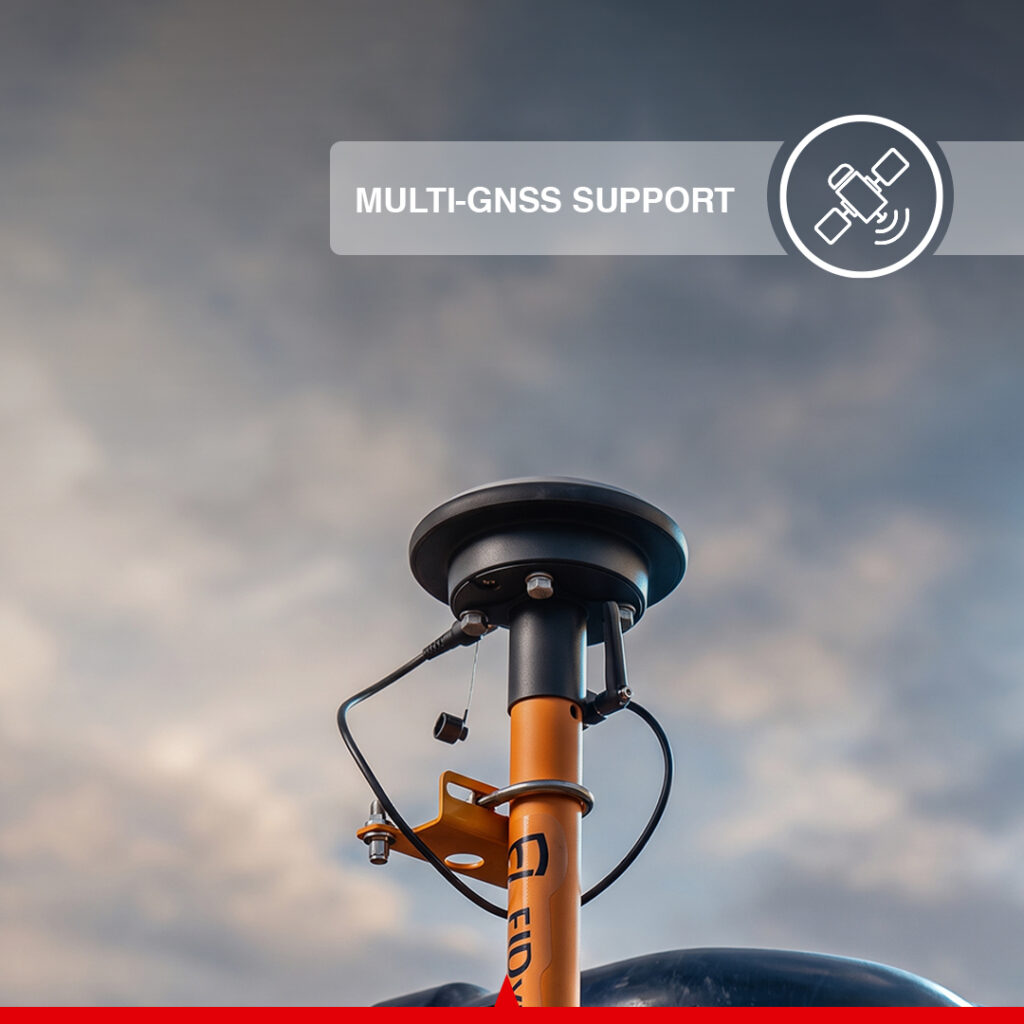
Canamek X70L Excavator Guidance System
- Guidance accuracy within ±3 cm (±1.18 in)
- Dual-IMU positioning architecture
- 1,408-channel multi-GNSS receiver
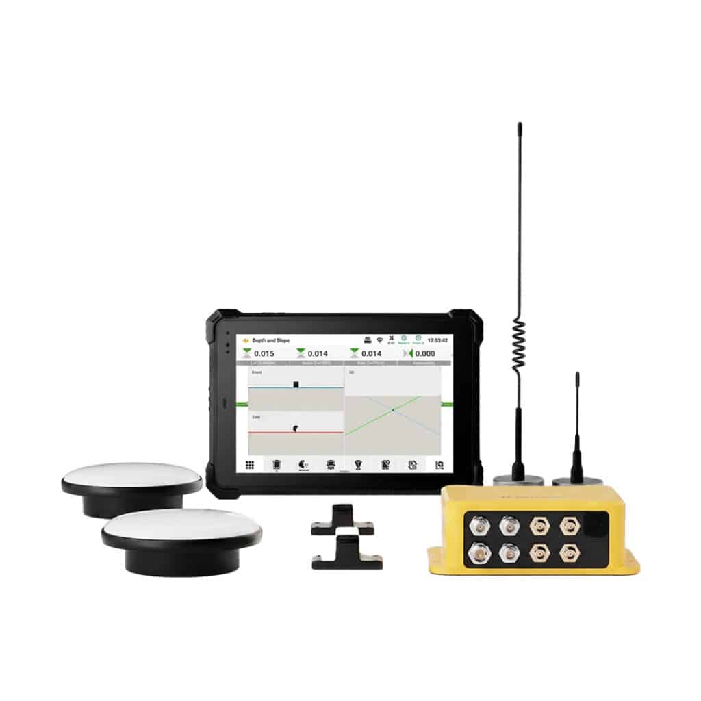
- 25.7 cm (10.1 in) rugged IP68 field display
- Fast setup and simplified calibration
- Compatible with swing and offset boom excavators
- Depth control, slope control, trenching, and field layout
- NTRIP, Base Station RTK, and PPP support
- Optional 400 MHz / 900 MHz radio connectivity
- Optional support for 6,000+ predefined coordinate systems
- Optional DWG, DXF, SHP, KML, and XML file support
- Designed to reduce surveying dependency, rework, and setup time
Ships in 24h
Extend to 5
Available add-on
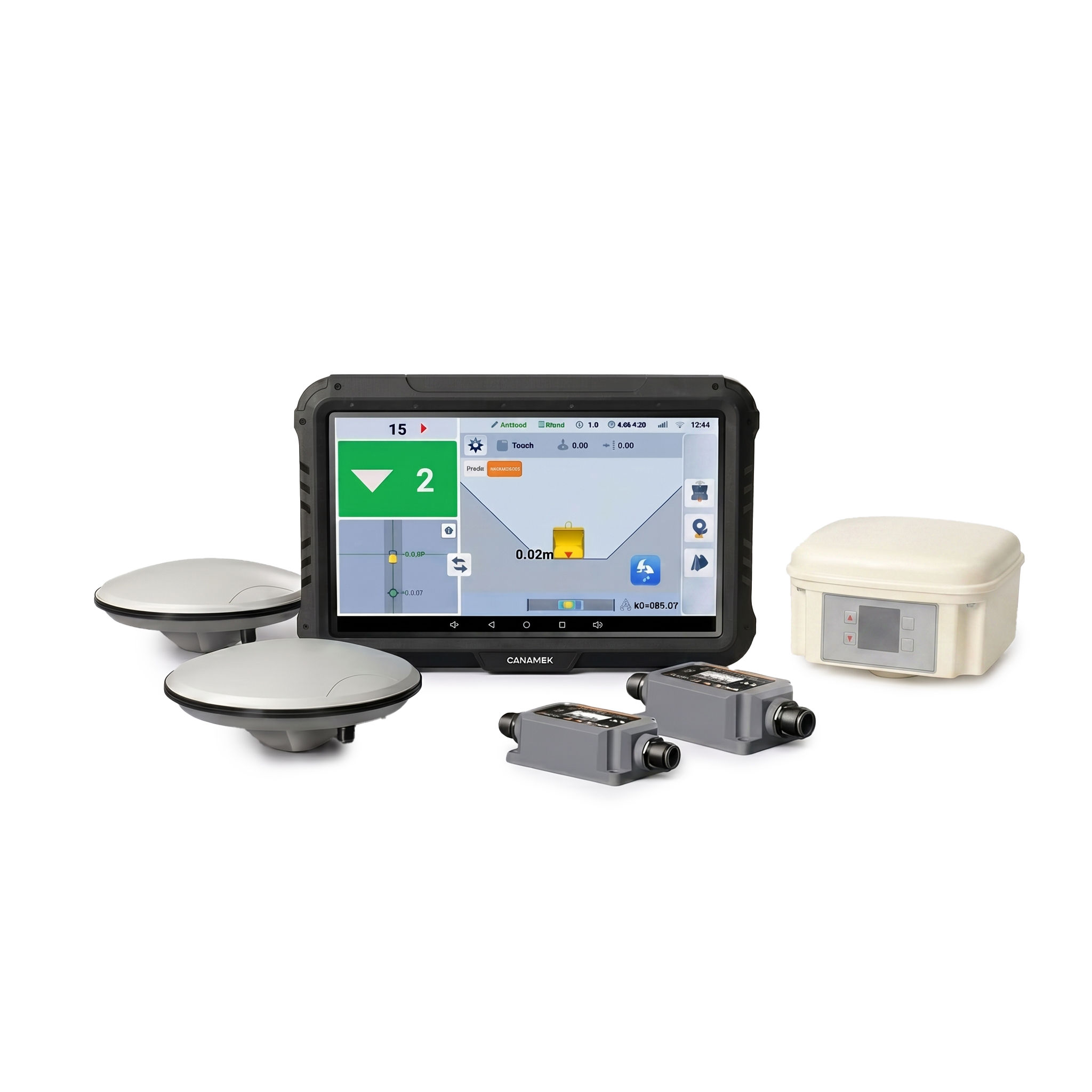
Canamek X70L Excavator Guidance System
Canamek X70L Excavator Guidance System
The Canamek X70L is an advanced excavator guidance solution designed to improve accuracy, efficiency, and repeatability across construction, infrastructure, utility, earthmoving, land preparation, and site-development projects.
Built around a multi-GNSS positioning system and dual-IMU architecture, the Canamek X70L provides operators with precise machine guidance for maintaining required excavation depth, elevation, slope, and project geometry.
With guidance accuracy within ±3 cm (±1.18 in), a rugged 25.7 cm (10.1 in) field display, simplified cabling, and a streamlined installation process, the X70L helps contractors increase daily productivity while reducing unnecessary rework and dependence on conventional grade-checking methods.
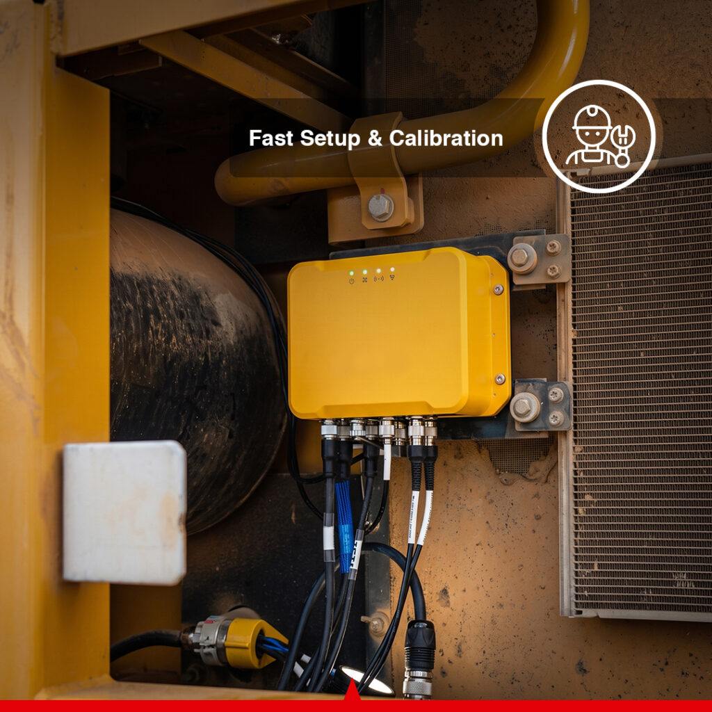
Fast Setup & Easy Calibration
The Canamek X70L is engineered for faster installation and straightforward calibration.
Its wired architecture uses simplified cabling and fewer components to reduce installation complexity. The system supports guided total-station calibration through a simple five-step workflow, helping contractors prepare machines for operation faster and minimize setup time between projects.
This streamlined setup makes the X70L particularly suitable for fleets where equipment may frequently move between different jobsites.
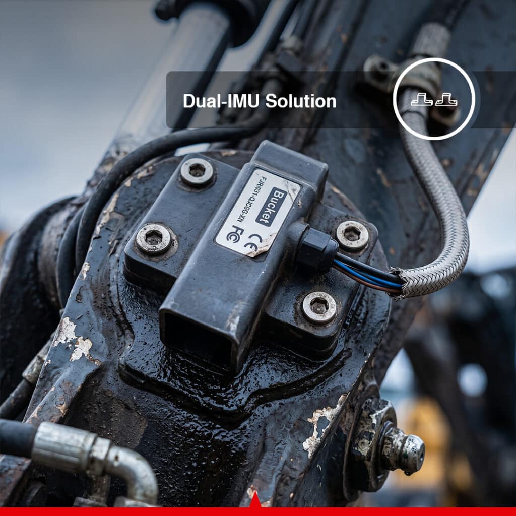
Dual-IMU Guidance Technology
The Canamek X70L incorporates a dual-IMU solution for accurate machine movement and orientation tracking.
The IMU module provides:
- Resolution below 0.05°
- Output frequency up to 100 Hz
- Static accuracy of 0.15°
- Dynamic accuracy of 0.50°
- Operating temperature from -40°C to 85°C (-40°F to 185°F)
- IP67 environmental protection
The dual-IMU architecture works together with the GNSS positioning system to provide reliable machine guidance during excavation operations.
Multi-GNSS Positioning
The Canamek X70L control module incorporates a 1,408-channel multi-GNSS receiver supporting several major satellite constellations:
- GPS
- GLONASS
- Galileo
- BeiDou
- QZSS
Available positioning and correction methods include:
- NTRIP
- Base Station RTK
- PPP
The GNSS receiver is specified with an RMS positioning accuracy of:
- Horizontal: 0.8 cm + 1 ppm (0.31 in + 1 ppm)
- Vertical: 1.5 cm + 1 ppm (0.59 in + 1 ppm)
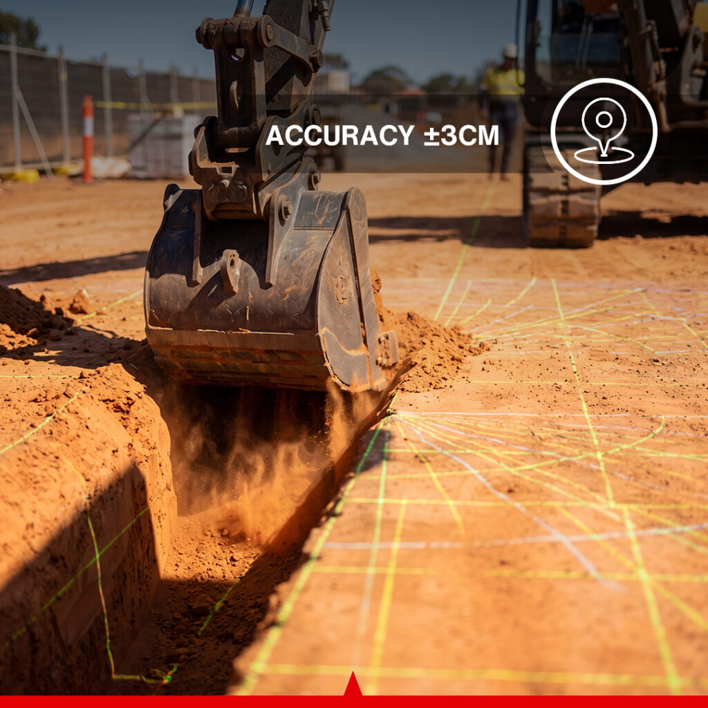
The complete excavator guidance system is specified to provide guidance accuracy within ±3 cm (±1.18 in).
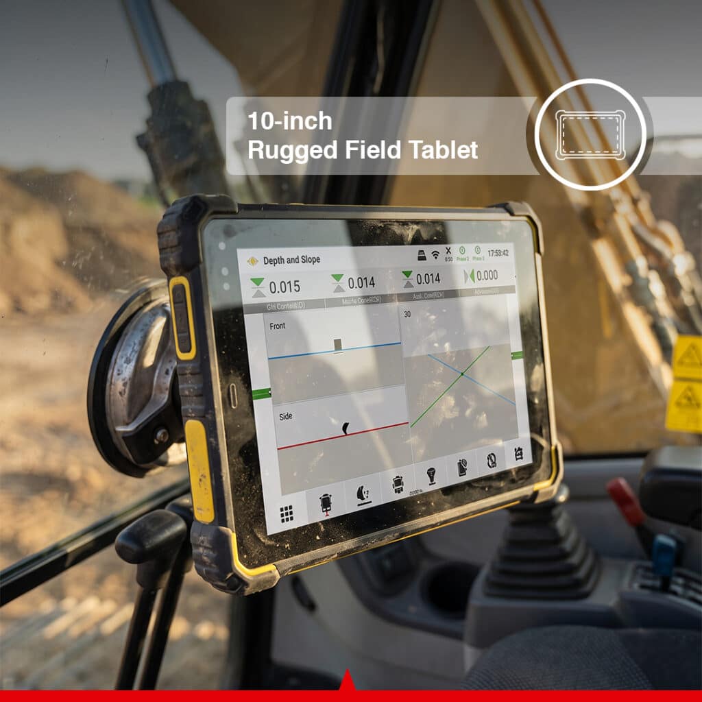
Rugged 25.7 cm / 10.1 in Field Display
Operators interact with the Canamek X70L through a rugged high-brightness field display designed for demanding construction environments.
The central display features:
- 25.7 cm (10.1 in) display
- 1920 × 1200 resolution
- 750 cd/m² (750 nits) brightness
- 8 GB RAM
- 128 GB ROM
- Octa-core 2.2 GHz processor
- IP68 protection
- 10,000 mAh / 3.8 V lithium battery
- Wi-Fi connectivity
- Bluetooth 5.0 BLE
- 2G / 3G / 4G cellular connectivity
The display operates in temperatures ranging from -20°C to 60°C (-4°F to 140°F) and is designed for outdoor machine-control environments.
Multiple Work Modes
The Canamek X70L supports multiple excavation and machine-guidance workflows.
Depth Control
Helps operators maintain the required excavation depth while reducing repeated manual measurements and grade checks.
Slope Control
Provides guidance for specified slopes and grades in embankment construction, drainage work, channels, road construction, and site preparation.
Trenching
Supports accurate trench depth and profile control for utility, drainage, infrastructure, and pipeline applications.
Field Layout
Allows project positioning information to be used during field construction and excavation operations.
These work modes allow the Canamek X70L to be used across multiple stages of earthmoving and construction projects.
Compatible with Swing & Offset Boom Excavators
The Canamek X70L is suitable for excavators equipped with swing or offset boom configurations.
This capability makes the system suitable for machines operating in:
- Confined construction areas
- Utility corridors
- Roadside excavation
- Sloped terrain
- Ditching projects
- Urban construction environments
The boom-mounted GNSS configuration provides precise guidance without requiring complex additional hardware.
Lower Cost, Higher Daily Output
The Canamek X70L is designed to improve operational efficiency through fewer components, reduced calibration requirements, and lower dependence on conventional surveying.
Using guidance information directly in the excavator can help contractors achieve:
- Faster excavation cycles
- Reduced surveying dependency
- Less rework
- More consistent finished surfaces
- Faster machine deployment
- Improved project accuracy
- Higher daily machine productivity
This combination makes the X70L a practical solution for contractors seeking to improve machine utilization and project efficiency.
Global Coordinate System Support – Optional
An optional coordinate-system feature provides access to more than 6,000 predefined coordinate systems worldwide.
This capability helps simplify project setup across different countries and regions while reducing the need for extensive manual coordinate-system configuration.
Multi-Layer Design File Support – Optional
Optional multi-layer functionality enables the Canamek X70L to work with multiple engineering and geospatial file formats, including:
- DWG
- DXF
- SHP
- KML
- XML
Layer visualization helps operators work with complex drawings and project information more efficiently.
Connected Jobsite Management
The supplied system architecture also supports connected jobsite-management workflows covering:
Device Management
Monitor machine location, operating status, and utilization to support equipment allocation and dispatching.
Project Management
Centralize project progress and resource information to improve visibility, planning, and project control.
Cross-Team Collaboration
Keep design information and field information synchronized between office and jobsite teams to improve communication and coordination.
Frequently Asked Questions
What is the Canamek X70L?
The Canamek X70L is an advanced excavator guidance system combining multi-GNSS positioning, dual-IMU technology, a rugged field display, and digital project information to provide accurate machine guidance for excavation and earthmoving operations.
What is the guidance accuracy of the Canamek X70L?
The Canamek X70L provides guidance accuracy within ±3 cm (±1.18 in). The GNSS receiver itself is specified at 0.8 cm + 1 ppm (0.31 in + 1 ppm) horizontal RMS and 1.5 cm + 1 ppm (0.59 in + 1 ppm) vertical RMS under applicable positioning conditions.
Which GNSS constellations does the Canamek X70L support?
The Canamek X70L supports GPS, GLONASS, Galileo, BeiDou, and QZSS through its 1,408-channel multi-GNSS receiver.
Does the Canamek X70L support RTK corrections?
Yes. Supported positioning connection methods include NTRIP, Base Station RTK, and PPP.
Can the Canamek X70L be installed on swing or offset boom excavators?
Yes. The system is designed to support swing and offset boom excavators, making it suitable for confined areas, trenching, ditching, slope work, and urban construction environments.
What work modes does the Canamek X70L support?
The system supports depth control, slope control, trenching, and field layout applications.
What display is included with the Canamek X70L?
The system features a rugged 25.7 cm (10.1 in) display with 1920 × 1200 resolution, 750 cd/m² (750 nits) brightness, 8 GB RAM, 128 GB ROM, an octa-core 2.2 GHz processor, and IP68 protection.
What is the operating temperature range of the display?
The central display operates from -20°C to 60°C (-4°F to 140°F) and can be stored from -30°C to 70°C (-22°F to 158°F).
Does the Canamek X70L support cellular connectivity?
Yes. The central display supports 2G, 3G, and 4G connectivity, including GSM, WCDMA, TD-SCDMA, CDMA2000, LTE-FDD, and LTE-TDD networks.
Can the Canamek X70L work with CAD and GIS files?
Yes. With the optional multi-layer functionality, the system supports DWG, DXF, SHP, KML, and XML files.
Does the Canamek X70L support international coordinate systems?
Yes. An optional feature supports more than 6,000 predefined coordinate systems worldwide.
Does the Canamek X70L support an external radio?
Yes. Optional radio configurations support 410–470 MHz and 902–928 MHz frequency ranges.
Is the Canamek X70L suitable for harsh outdoor environments?
Yes. Major system components are designed for demanding field environments. The control module and IMU are rated IP67, while the central display is rated IP68. Depending on the component, specified operating temperatures extend as low as -40°C (-40°F) and as high as 85°C (185°F).
How can the Canamek X70L improve excavation productivity?
The system provides accurate guidance directly to the excavator operator, helping reduce manual grade checking, surveying dependency, unnecessary excavation, and rework while improving consistency and daily machine productivity.
Full data sheet
| Choose | Core Version | Standalone GPS | Turnkey Version |
Control Module
| Specification | Canamek X70L |
|---|---|
| Size | 200 × 155 × 63 mm / 7.87 × 6.10 × 2.48 in |
| Communication | Wi-Fi, BT, Ethernet |
| Power Supply | 9–36 V |
| Operating Temperature | -40°C to 60°C / -40°F to 140°F |
| Storage Temperature | -40°C to 85°C / -40°F to 185°F |
| IP Rating | IP67 |
| GNSS Channels | 1,408 channels |
| GNSS Connection | NTRIP, Base Station RTK, PPP |
| Horizontal Positioning Accuracy (RMS) | 0.8 cm + 1 ppm / 0.31 in + 1 ppm |
| Vertical Positioning Accuracy (RMS) | 1.5 cm + 1 ppm / 0.59 in + 1 ppm |
| Optional 400 MHz Radio Range | 410 MHz to 470 MHz |
| Optional 900 MHz Radio Range | 902 MHz to 928 MHz |
| Wi-Fi Frequency Range | 2400 MHz to 2500 MHz |
Supported GNSS Frequency Bands
| GNSS Constellation | Supported Bands |
|---|---|
| BeiDou / BDS | B1I, B2I, B3I, B1C, B2a |
| GLONASS | L1, L2 |
| Galileo | E1, E5a, E5b |
| GPS | L1C/A, L1C, L2P(W), L2C, L5 |
| QZSS | L1, L2, L5 |
IMU Module
| Specification | Value |
|---|---|
| Resolution | <0.05° |
| Operating Voltage | 9–32 V DC |
| Output Frequency | Up to 100 Hz |
| Operating Temperature | -40°C to 85°C / -40°F to 185°F |
| IP Rating | IP67 |
| Max Angular Rate | <400* |
| Static Accuracy | 0.15° |
| Dynamic Accuracy | 0.50° |
*The source brochure specifies the maximum angular rate as “<400” without displaying a unit. Therefore, no unit has been added or assumed.
Central Display
| Specification | Value |
|---|---|
| Size | 284 × 189 × 22.5 mm / 11.18 × 7.44 × 0.89 in |
| Display Size | 25.7 cm / 10.1 in |
| Resolution | 1920 × 1200 |
| Brightness | 750 cd/m² / 750 nits |
| Memory | 8 GB RAM, 128 GB ROM |
| CPU | Octa-core 2.2 GHz |
| Power Supply | 7–30 V DC |
| Wi-Fi | 802.11 b/g/n, 2.4 GHz |
| Bluetooth | 5.0 BLE |
| Battery | 10,000 mAh / 3.8 V Lithium |
| Operating Temperature | -20°C to 60°C / -4°F to 140°F |
| Storage Temperature | -30°C to 70°C / -22°F to 158°F |
| IP Rating | IP68 |
Cellular Network Support
| Network | Supported Bands |
|---|---|
| GSM | B2 / B3 / B5 / B8 |
| WCDMA | B1 / B2 / B5 / B8 |
| TD-SCDMA | B38 / B39 / B40 / B41 |
| CDMA | CDMA2000 |
| LTE-FDD | B1 / B2 / B3 / B4 / B5 / B7 / B8 / B28 |
| LTE-TDD | B38 / B39 / B40 / B41 |
Central Display Interfaces
| Interface | Quantity / Specification |
|---|---|
| USB Type-C | ×1, supports OTG |
| USB Type-A | ×1, USB 2.0 |
| Earphone Jack | ×1, 3.5 mm / 0.14 in standard audio jack |
| TF Card Slot | ×1 |
| SIM Card Slot | ×1, Standard Micro SIM |
| DC Power Port | ×1 |
| RJ45 Port | ×1 |
| RS232 Serial Port | ×1 |
| POGO PIN Connector | ×1, USB + Charging |
Wi-Fi / Bluetooth Antenna
| Specification | Value |
|---|---|
| Frequency Range | 2400 MHz to 2500 MHz |
| VSWR | ≤2 |
| Gain | 2.8 dB |
| Operating Temperature | -20°C to 65°C / -4°F to 149°F |
| Impedance | 50 Ω |
Radio Antenna
| Specification | Value |
|---|---|
| 400 MHz Frequency Range | 410 MHz to 470 MHz |
| 900 MHz Frequency Range | 902 MHz to 928 MHz |
| Gain | 3 ± 0.5 dB |
| VSWR | ≤2 |
| Impedance | 50 Ω |
| Operating Temperature | -20°C to 65°C / -4°F to 149°F |
Where it earns its keep
Precision Utility Trenching for Municipal Networks
The Canamek X70L provides accurate excavation guidance for municipal utility trenching, including water lines, drainage systems, electrical infrastructure, telecommunications, and other underground networks.
Real-time depth and positioning guidance helps operators maintain the specified trench profile while reducing repeated manual measurements.
Land Leveling & Field Preparation
The X70L can be used for land shaping and field preparation where operators must follow predefined elevations and slopes.
Typical applications include:
- Agricultural land preparation
- Commercial site development
- Industrial construction
- Building site preparation
- General earthmoving
The system helps improve finished-grade consistency while reducing unnecessary material movement.
Highway & Embankment Slope Trimming
The Canamek X70L provides slope guidance for highway construction, embankments, cut slopes, and other infrastructure earthworks.
Operators can follow specified project geometry more consistently while reducing repeated manual grade checks.
Standardized Channel Excavation & Profiling
The system is suitable for excavation and profiling of standardized channel sections, including:
- Drainage channels
- Irrigation canals
- Waterways
- Ditches
- Engineered channels
Guidance information helps operators maintain required depth, slope, and section geometry.
Solar PV Pile Layout & Installation
The Canamek X70L can support earthmoving and positioning operations associated with utility-scale solar projects.
Digital project information can assist crews during site preparation and pile-layout operations for large photovoltaic installations.
Road Construction & Earthworks
The X70L is suitable for road and highway construction projects requiring controlled excavation, grading, slope trimming, and embankment preparation.
These application scenarios are specifically represented in the supplied product brochure.
Be the first to review this product.
Ready to deploy.
Out of the case.
Every unit ships with everything needed to put it to work in under an hour.
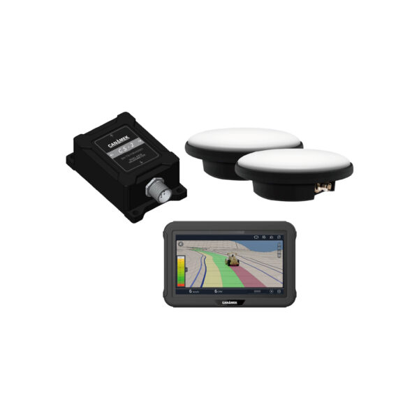
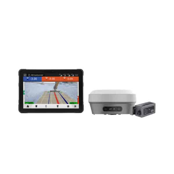
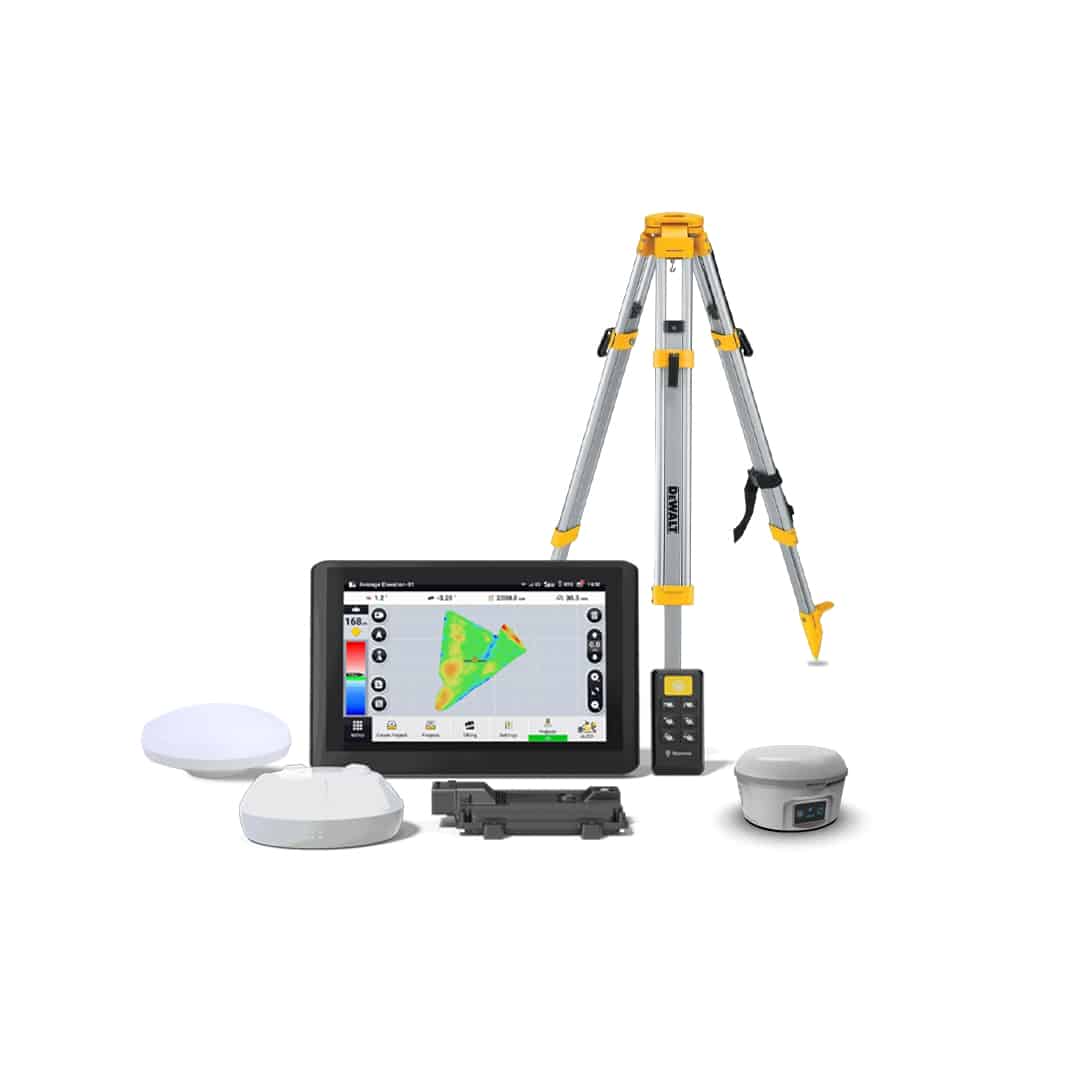
- Full system unit
- Mounting hardware
- Power cable + charger
- Hard transit case
- Quick-start guide + warranty card
Build the full system
Get sizing help and tech answers from a real human, in <2 min.
Call +1 (855) CANAMEKTell us your acreage and crop, get a turnkey estimate in 24 hours.
Email sales →
Write a review