
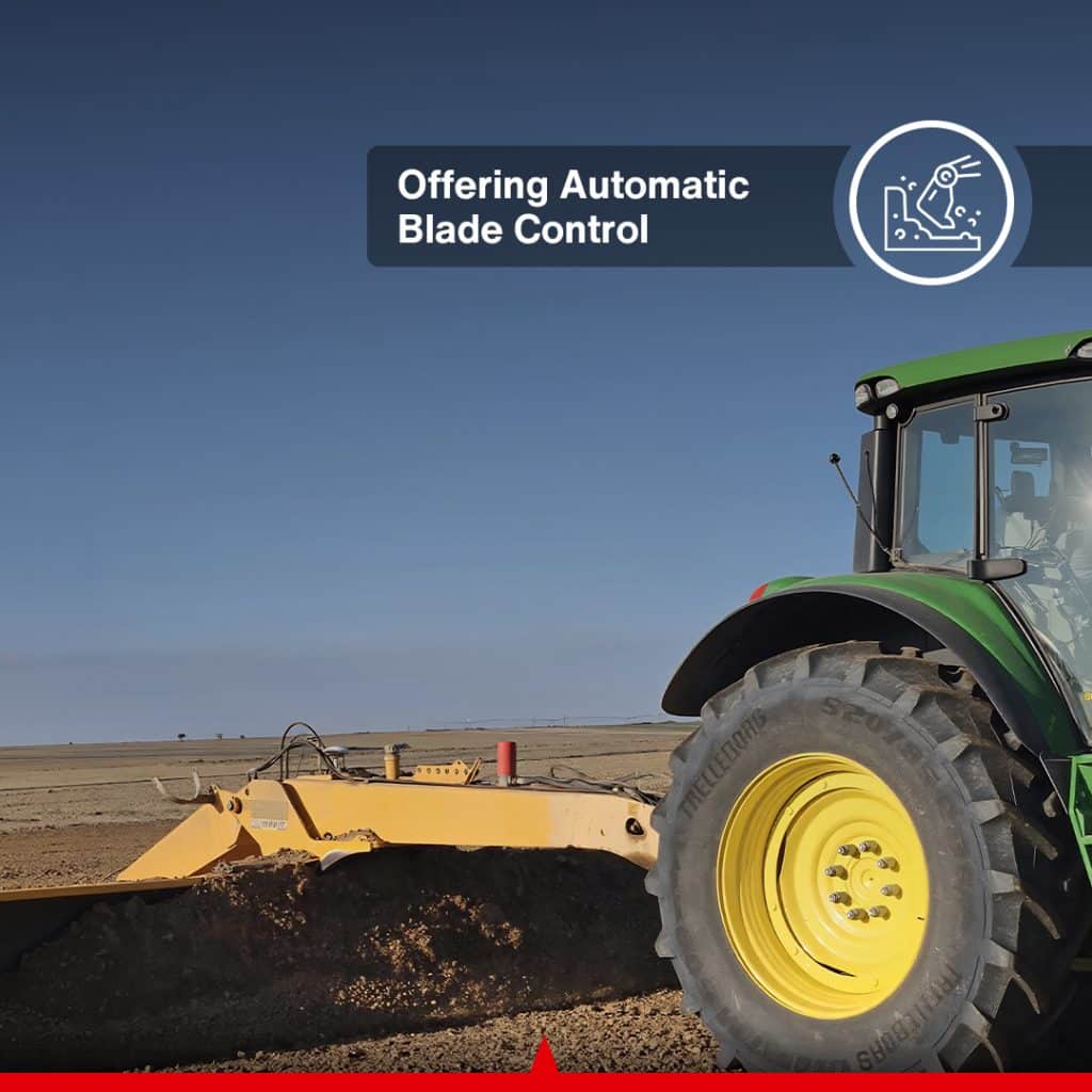
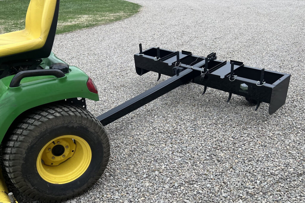
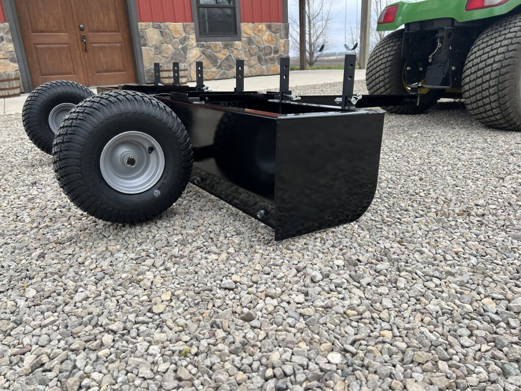
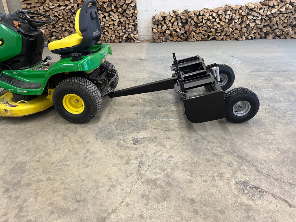
ACTU-Blade GPS automated Box Blade Control Kit
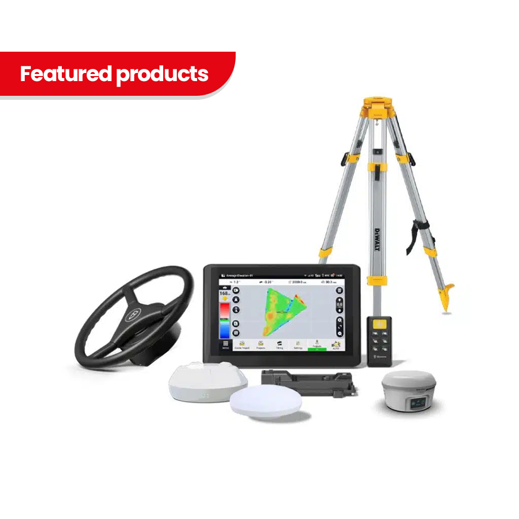
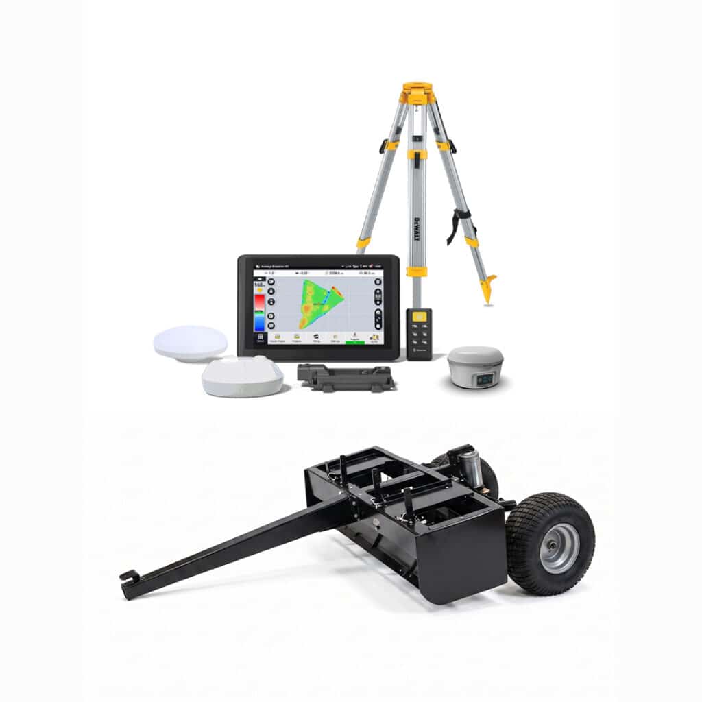
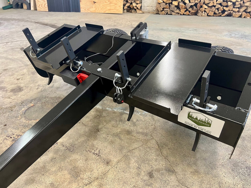
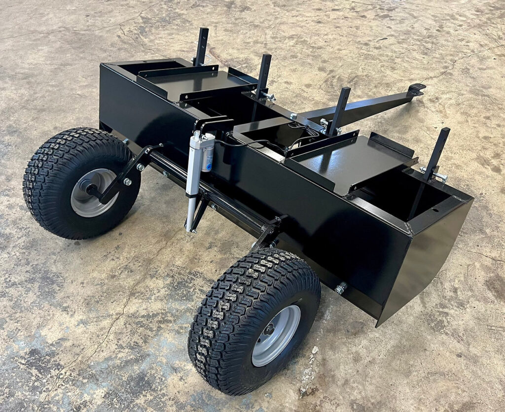
Complete GNSS land leveling and grading system combining CANAMEK's surveying, terrain-design and automatic blade-control technology with an included box blade.
- Integrated GNSS surveying, terrain design and automatic grading
- Complete system with box blade included
- Available in 4 ft / 1.22 m, 5 ft / 1.52 m and 6 ft / 1.83 m blade sizes
- Supports level, single-slope and dual-slope surface designs
- Automatic hydraulic blade control with real-time 3D project visualization
- 2-Year Free Warranty
- Made in Canada
- After-Sales Support, 7 Days a Week
Expédié en 24h
Prolonger jusqu'à 5
Module complémentaire disponible
ACTU-Blade GPS automated Box Blade Control Kit
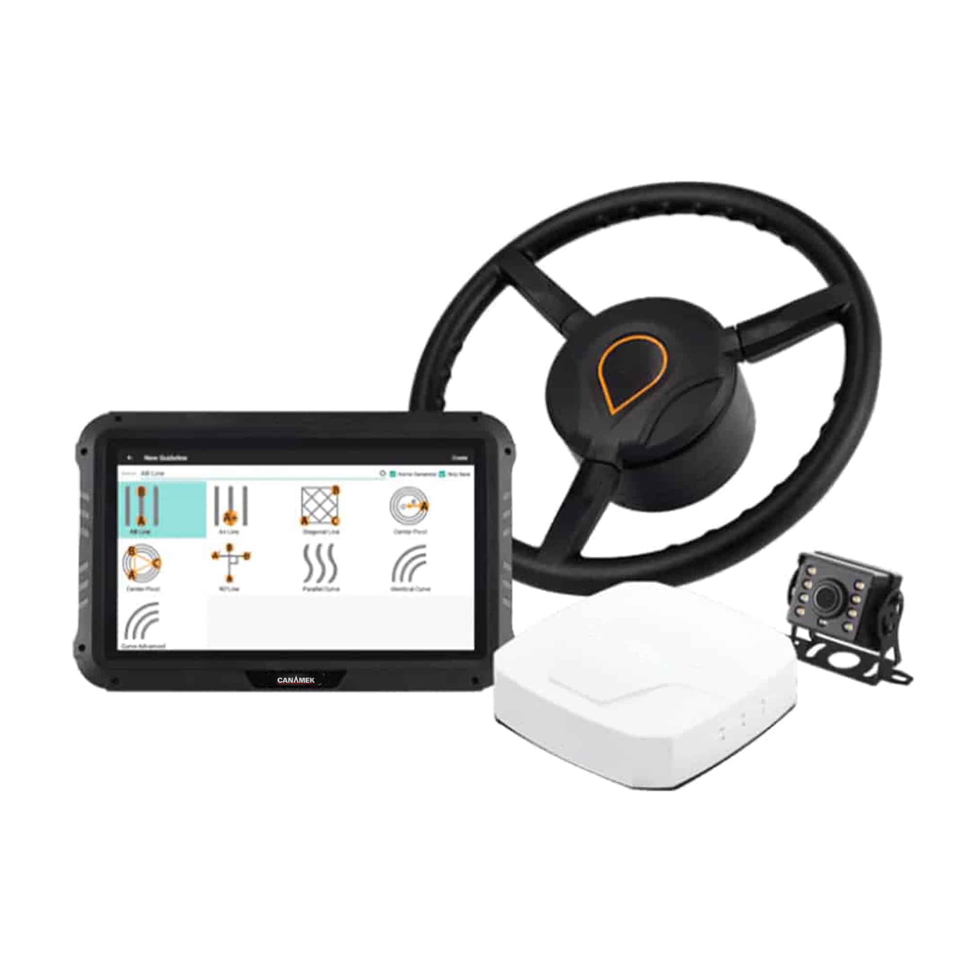
Le ACTU-Blade GPS Automated Box Blade Control Kit is a complete GNSS-based grading solution developed for precision land leveling, agricultural drainage management, field surveying, terrain design and automatic box blade control.
Built on the same surveying, design and machine-control platform as the CANAMEK TOPO-mizer, ACTU-Blade adds the grading blade itself to create an integrated package for customers who require both the GNSS control system and the physical grading implement.
Designed for farmers, land-leveling contractors, irrigation professionals, drainage specialists and grading operators, ACTU-Blade allows the operator to survey existing terrain, prepare a proposed surface, calculate cut-and-fill requirements and automatically control the included box blade according to the approved digital design.
Available blade widths include 4 ft / 1.22 m, 5 ft / 1.52 m and 6 ft / 1.83 m.
Complete Survey, Design, and Box Blade Control Workflow
ACTU-Blade integrates the primary stages of a land-leveling project into one GNSS grading system.
Operators can survey the field, analyze existing elevations, prepare the required surface design, calculate earthmoving requirements and automatically control the box blade directly from the control terminal.
The system supports:
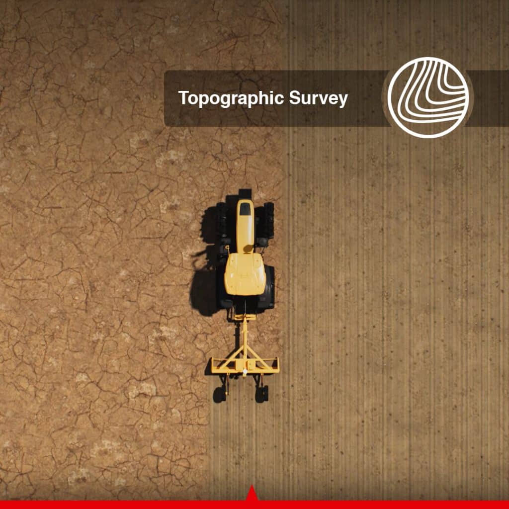
- Topographic Survey
- Terrain and Surface Design
- Automatic Box Blade Control
- Cut-and-Fill Calculation
- Real-Time Project Visualization
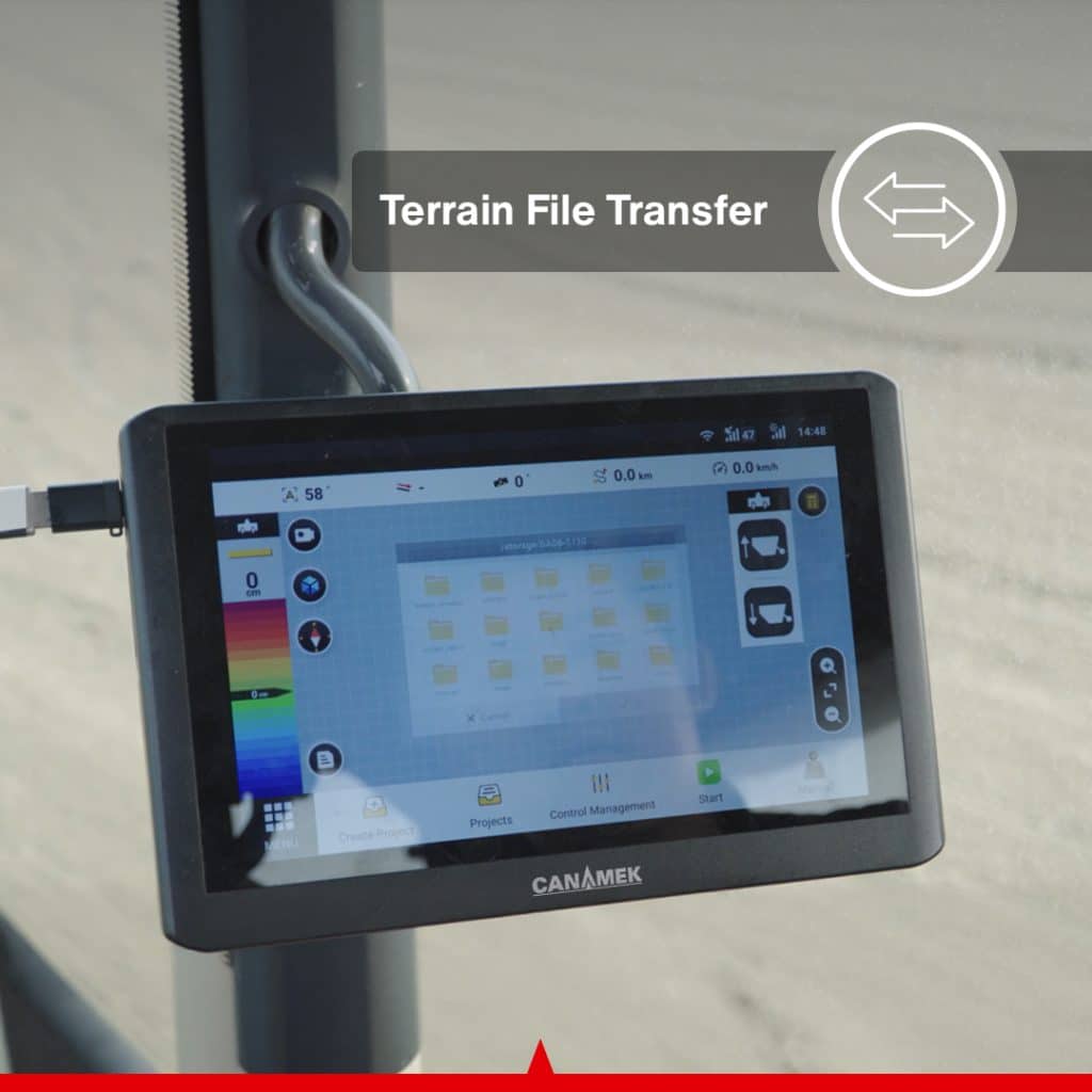
- Project Data Import and Export
- PDF Reporting and Record Keeping
- Remote Diagnostics and Assistance
- Multi-Machine Project Collaboration
Because the grading blade is included with ACTU-Blade, the system combines the digital surveying and machine-control platform with the implement used to carry out the grading work.
Choose the ACTU-Blade Size for Your Application
ACTU-Blade is available with three box blade widths:
4 ft / 1.22 m Box Blade
A compact blade-width option for applications where a narrower grading implement is preferred.
5 ft / 1.52 m Box Blade
A mid-size option providing additional working width while retaining a compact grading configuration.
6 ft / 1.83 m Box Blade
The widest currently available ACTU-Blade configuration for customers requiring greater grading coverage per pass.
Blade selection should be based on the intended machine, project requirements and working conditions.
Levé topographique de haute précision
ACTU-Blade collects real-time topographic elevation data directly from the grading system.
The field survey creates a digital representation of the existing surface and allows the operator to identify:
- High and low areas
- Depressions that retain water
- Uneven field elevations
- Restrictions de drainage
- Excessive slopes
- Areas requiring excavation or filling
- Locations where water flow must be improved
For straightforward surface profiles, surveying and terrain preparation can be completed through the control system without requiring separate surveying equipment for each stage of the workflow.
Optimized Surface Designs with Minimum Earth Movement
Using collected topographic information, ACTU-Blade allows the operator to prepare optimized surface designs based on the required elevation, drainage direction and grading objectives.
Operators can configure project parameters including:
- Altitude cible
- Sens de l'écoulement de l'eau
- Pente longitudinale
- Dévers
- Single- or dual-slope configuration
- Cut-and-fill ratio
- Proposed surface elevation
- Earthmoving volume
- Drainage direction
Reducing unnecessary soil movement can help reduce machine operating time, fuel consumption and excessive soil disturbance while allowing the operator to meet the required project design.
The control terminal can also display estimated earthmoving quantities in cubic yards and cubic metres.
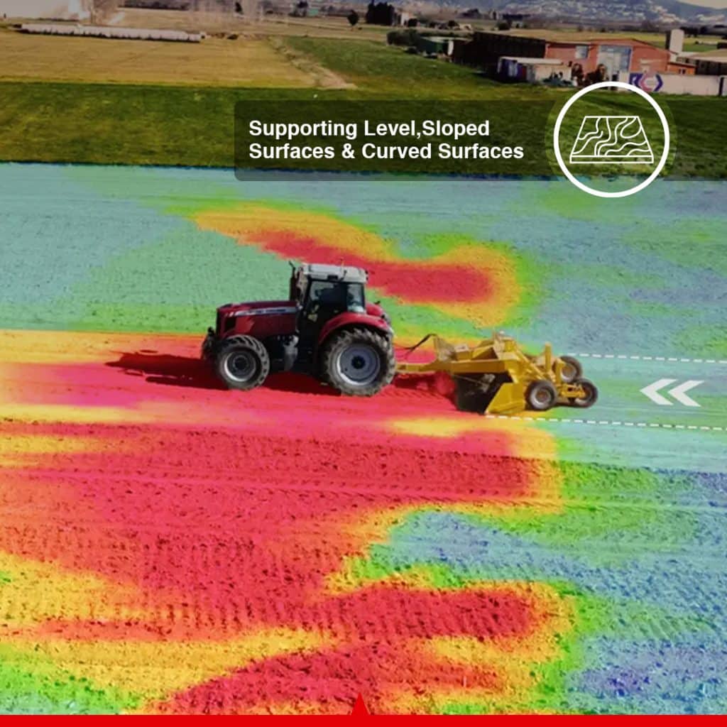
Supporting Level and Sloped Surfaces
Different agricultural and grading projects require different surface configurations. ACTU-Blade supports multiple terrain-design types.
Level Surface
Creates a consistent target elevation across the project area for applications requiring a uniformly level surface.
Single-Slope Surface
Creates one continuous slope to move irrigation or surface water in a selected direction.
Double-Surface or Dual-Slope Design
Creates two connected surface planes for projects requiring split drainage directions or more complex surface geometry.
This flexibility allows ACTU-Blade to be used for level fields, sloped agricultural ground, drainage-sensitive land and other grading projects where controlled surface geometry is required.
Automatic Box Blade Control
ACTU-Blade continuously compares the actual blade position with the approved digital surface design.
The Vehicle Control Unit communicates with the hydraulic control system and automatically adjusts the grading blade according to the required elevation and slope.
Depending on the hydraulic configuration, system functions can include:
- Blade movement up and down
- Left and right tilt movement
- Commande d'ascenseur
- Tilt control
- Combined lift-and-tilt operation
- Automatic and manual operating modes
Automatic blade control reduces the need for constant manual adjustment and helps the operator maintain the required elevation and surface profile throughout the project.
Wireless Blade Control
An optional wireless remote provides convenient access to essential grading functions from inside the operator’s cab.
Depending on the hydraulic configuration, the remote can be used for:
- Moving the blade up
- Moving the blade down
- Controlling blade tilt
- Switching between automatic and manual modes
- Making blade adjustments during setup and operation
This provides direct access to frequently used blade-control functions without requiring every adjustment to be made through the touchscreen.
Integrated GNSS and Attitude Compensation
ACTU-Blade uses a high-precision GNSS receiver with an integrated IMU attitude sensor to monitor the position and movement of the machine and grading system.
Integrated attitude compensation helps maintain stable blade control as the machine operates across uneven terrain and experiences pitch, roll, vibration or changing ground conditions.
A second GNSS antenna can also be used in compatible configurations where additional implement-position or attitude information is required.
Vue de projet en couleur 3D
The ACTU-Blade control terminal provides a color-coded 3D representation of the surveyed terrain and proposed project surface.
The display can show:
- Existing terrain elevations
- High and low areas
- Cut zones
- Fill zones
- Proposed surface design
- Position actuelle de la machine
- Current grading direction
- Blade elevation status
- Limites du projet
- Remaining earthmoving requirements
The machine’s live position can be viewed within the project during operation, allowing the operator to monitor grading progress directly from the cab.
The interface also supports operation in low-light conditions.
Step-by-Step Grading Using Elevation Offsets
Some projects require more material to be removed than the machine and box blade should move in a single pass.
ACTU-Blade can apply elevation offsets to the designed surface so the operator can approach the final target elevation through multiple controlled passes.
Step-by-step elevation offsets can help:
- Match grading depth to machine capacity
- Reduce excessive machine loading
- Improve blade stability
- Reduce wheel slip
- Reduce hydraulic stress
- Maintain controlled grading depth
- Improve grading consistency
This allows deeper grading work to be divided into manageable stages while maintaining reference to the final digital design.
Optimize Water Flow and Field Drainage
ACTU-Blade can be used to create controlled agricultural surfaces designed to improve water movement across the field.
By correcting elevation differences, removing surface depressions and creating planned slopes, the system can help direct excess water toward drainage channels, outlets, ditches or designated collection areas.
Improved surface drainage can help:
- Reduce standing water
- Correct low areas that remain wet
- Improve soil aeration
- Improve root-zone conditions
- Réduire le ruissellement non contrôlé
- Improve irrigation uniformity
- Améliorer l'accès aux machines
- Reduce the time required for wet areas to dry
The result is a more manageable field surface designed around both irrigation and drainage requirements.
Eliminate Water-Holding Depressions
Uneven agricultural fields can contain low areas that retain water after rainfall or irrigation.
These areas can contribute to:
- Delayed planting
- Delayed cultivation
- Reduced usable planting area
- Weed development in standing-water areas
- Poor crop establishment
- Root damage
- Compactage du sol
- Machinery-access problems
- Greater risk of machinery becoming stuck
ACTU-Blade allows these low areas to be identified during the survey and incorporated into the proposed grading design.
Correcting persistent depressions can help create a more uniform field surface and reduce recurring standing-water areas.
More Uniform Drying and Better Field Management
A more consistently graded and drained field can dry more uniformly after rainfall or irrigation.
More uniform drying can improve the timing of:
- Seedbed preparation
- Planting
- Fertilizer application
- Spraying
- Cultivation
- Harvesting
- Drainage maintenance
Reducing persistent wet areas can prevent a small portion of the field from delaying operations across a larger area.
Reduce the Risk of Machinery Becoming Stuck
Standing water, saturated soil and persistent muddy areas can increase the risk of tractors and other agricultural equipment becoming stuck.
Recovery operations can result in:
- Lost working time
- Towing and recovery costs
- Field rutting
- Compactage du sol
- Equipment damage
- Crop damage
- Additional repair work
By correcting low areas and improving surface drainage, ACTU-Blade can help reduce the occurrence of excessively wet sections within the field.
Support More Uniform Crop and Field Conditions
A more uniform field surface can support more consistent water distribution and growing conditions.
Potential benefits of improved surface uniformity can include:
- More uniform crop emergence
- More consistent plant development
- Improved water distribution
- Reduced waterlogging
- Reduced moisture variation
- Improved nutrient distribution
- Augmentation de la surface de plantation exploitable
Improved surface conditions may contribute to better overall field performance.
Actual agronomic results depend on crop type, soil conditions, weather, irrigation practices, drainage infrastructure, project design and farm-management decisions.
Conserve Water and Reduce Soil Erosion
Uncontrolled slopes and uneven field surfaces can cause water to collect in some locations while moving too quickly through others.
ACTU-Blade allows the operator to control target elevation and slope according to irrigation and drainage requirements.
A properly designed surface can help:
- Improve irrigation efficiency
- Reduce unnecessary water use
- Reduce surface runoff
- Réduire l'érosion des sols
- Reduce topsoil movement
- Réduire le mouvement des nutriments
- Improve moisture consistency
- Reduce standing water
Controlled surface shaping can be particularly useful where water availability, runoff or erosion management is an important part of the project.
Improve Fertilizer and Input Management
Uneven water movement can transport agricultural inputs away from their intended application areas or concentrate them in low sections of the field.
Improved field uniformity and controlled water movement can help reduce:
- Fertilizer loss through runoff
- Nutrient accumulation in low areas
- Chemical movement
- Repeated treatment of waterlogged sections
- Weed development around standing-water areas
- Unnecessary input applications
These improvements may support more consistent use of fertilizers and other agricultural inputs.
Flexible Project Import and Export
ACTU-Blade supports digital project exchange for contractors, designers and multi-machine operations.
Operators can:
- Export surveyed field data
- Exporter les informations relatives à la conception du projet
- Transférer des projets entre des systèmes compatibles
- Import compatible third-party AGD design files
- Share files with contractors or project designers
- Générer des rapports de projet au format PDF
- Enregistrer les dossiers relatifs aux projets achevés
This allows surveying, project design and grading activities to be distributed between compatible machines and operators where required.
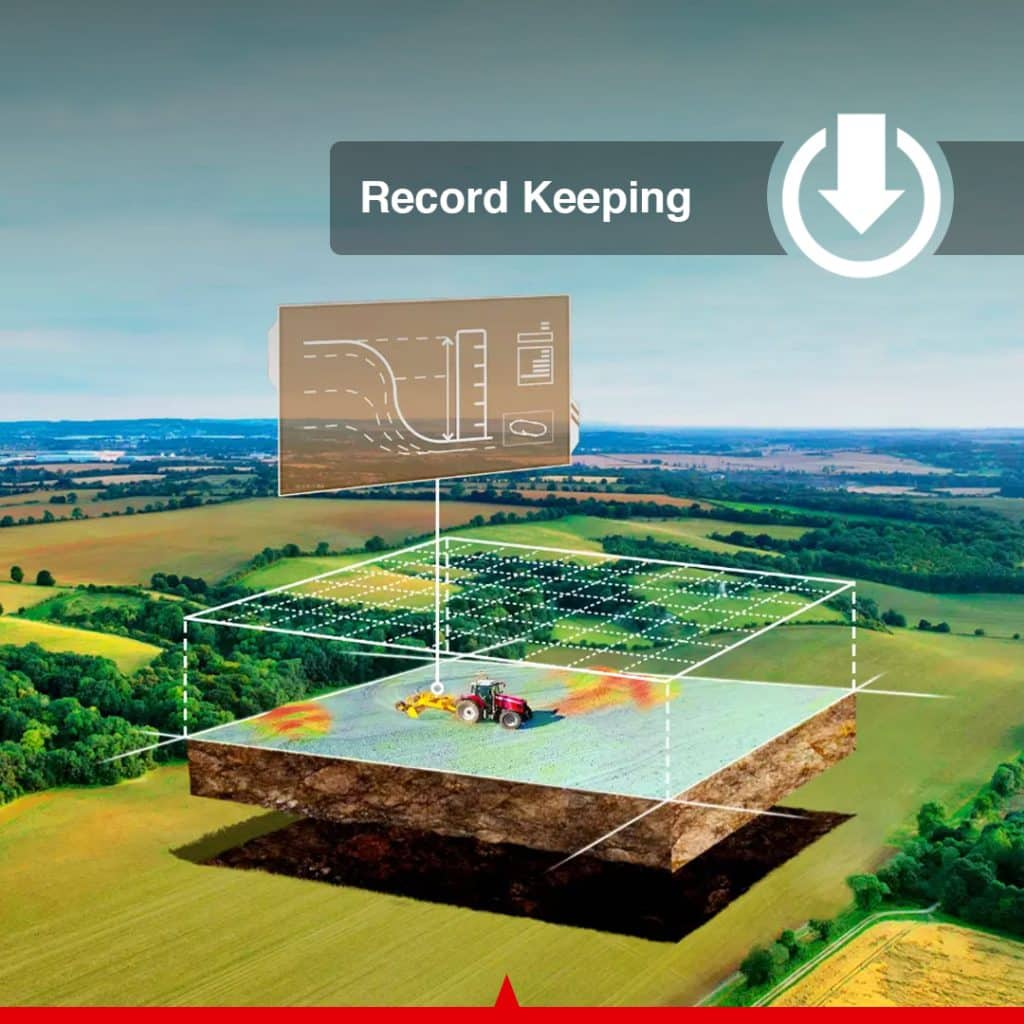
Record Keeping and Project Reporting
ACTU-Blade can generate digital project information and PDF reports for:
- Completed land-leveling projects
- Drainage projects
- Field surveys
- Surface designs
- Customer records
- Contractor documentation
- Future field improvements
- Long-term land-management records
Digital records allow completed project information to be retained and reviewed later without relying entirely on handwritten notes.
Remote Assistance and OTA Updates
ACTU-Blade supports remote assistance where the required cellular or internet connection is available.
Remote support can assist with:
- System diagnostics
- Configuration review
- Software troubleshooting
- Operational guidance
- Project setup
- Error identification
- System updates
Compatible over-the-air software updates allow software improvements to be delivered without requiring traditional manual update procedures.
Remote functions depend on connectivity and the available service configuration in the customer’s region.
Permanent Software with No Annual Tablet Fee
The system includes permanent access to the required tablet software for the purchased configuration.
Ownership benefits include:
- No annual tablet software subscription
- No recurring core software-license fee
- Permanent software for the purchased system
- Continued access to core surveying and grading functions
- No mandatory annual software renewal for standard operation
Optional future services, third-party connectivity, additional modules or separately purchased services may have different commercial terms.
Local GNSS Base Station Operation
ACTU-Blade uses the same GNSS land-leveling platform as TOPO-mizer and supports operation with a local GNSS base-station configuration.
A local base station can provide the correction source required for compatible high-precision grading without depending on a paid external CORS correction-network subscription.
The exact base-station hardware supplied with ACTU-Blade should follow the purchased system configuration.
Solutions for GPS Box Blade Grading and Land Leveling
ACTU-Blade provides an integrated grading solution for agricultural, drainage, reclamation and compatible earthmoving applications.
Typical applications include:
- Agricultural land leveling
- Precision field shaping
- Surface drainage management
- Irrigation preparation
- Paddy-field leveling
- Dryland leveling
- Row-crop field preparation
- Land reclamation
- Terrace development
- Level-surface grading
- Single-slope grading
- Dual-slope grading
- Drainage outlet preparation
- Water-flow management
- Farm-road grading
- Yard and site grading
- General box-blade grading
Commercial Package Benefits
ACTU-Blade combines the GNSS grading system with the box blade required to perform the grading work.
Key ownership and support benefits include:
- Box blade included
- Choice of three blade widths
- Integrated surveying and surface design
- Automatic hydraulic blade control
- Permanent tablet software
- No annual tablet software fee for standard operation
- Remote technical assistance
- OTA software updates
- Project import and export
- PDF project reporting
- 2-Year Warranty
- 7-Day-a-Week After-Sales Support
Key Features at a Glance
- Complete GNSS box blade grading system
- Box blade included
- 4 ft / 1.22 m blade option
- 5 ft / 1.52 m blade option
- 6 ft / 1.83 m blade option
- High-precision GNSS positioning
- Integrated IMU attitude sensor
- Topographic field surveying
- Optimized surface design
- Reduced unnecessary earth movement
- Level, single-slope and dual-slope surfaces
- Target-elevation adjustment
- Water-flow direction adjustment
- Slope adjustment
- Cut-and-fill calculation
- Automatic blade lift control
- Automatic blade tilt control
- Automatic and manual modes
- Optional wireless blade control
- 3D color-coded project view
- Live machine-position display
- Earthmoving volume calculation in cubic yards and cubic metres
- Step-by-step elevation offsets
- Compatible third-party AGD file import
- Project data export
- Multi-machine file sharing
- PDF reporting
- Remote diagnostics
- OTA software updates
- No annual tablet software subscription
Why Choose the ACTU-Blade GPS Automated Box Blade Control Kit?
ACTU-Blade combines surveying, terrain design, GNSS positioning, automatic hydraulic control and the grading box blade itself into one integrated land-leveling solution.
Rather than purchasing a GNSS machine-control system and sourcing a separate grading implement, ACTU-Blade provides the core technology and box blade together.
For farmers, this provides a practical system for field leveling, irrigation preparation, drainage improvement and correction of uneven agricultural surfaces.
For land-leveling contractors, ACTU-Blade provides an integrated survey-to-grade workflow with automatic blade control, earthmoving calculations, digital project transfer and project reporting.
For irrigation and drainage professionals, the system provides the tools required to survey existing terrain, prepare controlled slopes and carry out grading according to the approved digital surface.
Foire aux questions
What is the ACTU-Blade GPS Automated Box Blade Control Kit?
ACTU-Blade is a complete GNSS-based grading and land-leveling system that combines topographic surveying, terrain design, automatic hydraulic blade control and an included box blade.
How is ACTU-Blade different from TOPO-mizer?
ACTU-Blade uses the same core GNSS surveying, terrain-design and automatic blade-control platform as TOPO-mizer, but ACTU-Blade also includes the box blade used for grading.
Is the box blade included with ACTU-Blade?
Yes. ACTU-Blade is supplied as a GPS automated box blade system with the grading blade included.
What blade sizes are available?
ACTU-Blade is available with 4 ft / 1.22 m, 5 ft / 1.52 m and 6 ft / 1.83 m box blade options.
Can ACTU-Blade survey a field before grading?
Yes. ACTU-Blade can collect topographic elevation data that can be used to analyze the existing terrain and prepare the required surface design before grading begins.
Does ACTU-Blade automatically control the box blade?
Yes. The system compares the actual blade position with the approved terrain design and communicates with the hydraulic control system to automatically adjust the box blade.
What terrain designs does ACTU-Blade support?
The system supports level surfaces, single-slope surfaces and dual-slope or double-surface designs. Operators can configure elevation, slope, water-flow direction and cut-and-fill settings according to the project.
Can ACTU-Blade be used for field drainage?
Yes. ACTU-Blade can create controlled slopes and water-flow directions for surface drainage, irrigation preparation and related agricultural water-management projects.
Does ACTU-Blade help minimize earthmoving?
The system uses surveyed topographic information and adjustable design parameters to help the operator create a surface that meets project requirements while reducing unnecessary soil movement.
Can ACTU-Blade import externally prepared terrain designs?
Yes. The system supports compatible third-party AGD terrain-design files.
Can project files be transferred between compatible systems?
Yes. Project data can be exported and transferred between compatible systems for multi-machine grading and contractor operations.
Can ACTU-Blade export project reports?
Yes. The system can generate PDF project reports for record keeping, project management and contractor documentation.
Does ACTU-Blade use a conventional laser transmitter?
No. ACTU-Blade is a GNSS-based system and uses satellite positioning and GNSS correction data rather than a conventional rotating laser transmitter as its primary positioning reference.
What electrical supply does the ACTU-Blade control system require?
The main electronic components support a 9–36 V DC input range and are suitable for many machines using typical 12 V or 24 V DC electrical systems.
Is ACTU-Blade hardware protected against dust and water?
Yes. The control terminal is rated IP65, the GNSS receiver is rated IP66, and the Vehicle Control Unit and optional Easy Control keypad are rated IP67.
Does ACTU-Blade require an annual tablet software subscription?
No annual tablet software subscription is required for standard operation of the purchased system configuration. Optional future services, third-party connectivity or additional modules may have separate commercial terms.
Does ACTU-Blade support remote software updates?
Yes. The system supports remote assistance and compatible over-the-air software updates when the required network connection and support services are available.
Does ACTU-Blade include a warranty?
Yes. ACTU-Blade includes a 2-year warranty and CANAMEK after-sales support seven days a week.
Fiche technique complète
| Choose Blade Size" | 4ft | 5ft | 6ft |
ACTU-Blade Box Blade
| Spécification | Valeur |
|---|---|
| Included Implement | Box blade |
| Available Width | 4 ft / 1.22 m |
| Available Width | 5 ft / 1.52 m |
| Available Width | 6 ft / 1.83 m |
| Control Type | GNSS-based automatic hydraulic blade control |
| Operating Modes | Automatic and manual |
| Supported Surface Designs | Level, single-slope and dual-slope |
Terminal de commande
| Spécification | Valeur |
|---|---|
| Afficher | Écran tactile capacitif de 10,1 pouces / 256,5 mm |
| Rétroéclairage | DEL |
| Dimensions | 10,83 × 7,09 × 1,57 po / 275 × 180 × 40 mm |
| Mémoire | 2 Go de RAM |
| Stockage interne | 8 Go de ROM |
| Audio | Haut-parleur intégré |
| Power Input | 9 à 36 V CC |
| Supported Machine Voltage | Suitable for typical 12 V and 24 V DC machines |
| Mobile Network | 4G, backward-compatible with supported 2G/3G networks |
| 4G Frequency Bands | B1, B2, B3, B5, B8, B38, B39, B40 and B41 |
| Wi-Fi | 2,4 GHz |
| Wi-Fi Frequency Range | 2412–2484 MHz |
| Wi-Fi Output Power | 14 ± 2 dBm |
| Signaux reçus | GNSS/satellite, radio and 4G |
| Humidité relative | 0–951 TP3T à 104 °F / 40 °C, sans condensation |
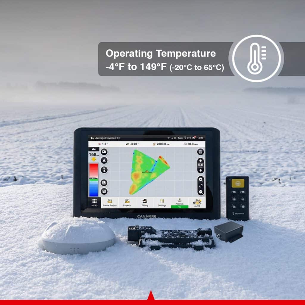
| Température de fonctionnement | −4°F à 158°F / −20°C à 70°C |
| Température de stockage | −40 °F à 185 °F / −40 °C à 85 °C |
| Ingress Protection | IP65 |
Récepteur GNSS
| Spécification | Valeur |
|---|---|
| Dimensions | 6,38 × 2,54 po / 162 × 64,5 mm |
| Power Input | 9 à 36 V CC |
| Courant de fonctionnement | Moins de 300 mA |
| Signaux GPS | L1 C/A, L1C, L2P(W), L2C et L5 |
| Signaux GLONASS | L1 et L2 |
| Signaux BeiDou | B1I, B2I, B3I, B1C et B2a |
| Signaux Galileo | E1, E5a et E5b |
| Augmentation | SBAS |
| Précision de l'accéléromètre de l'UIM | 0,5 mg |
| Précision du gyroscope de l'unité de mesure inertielle | 0,1 °/s |
| Spécification de roulis/tangage | 0.2° |
| Température de fonctionnement | −4°F à 158°F / −20°C à 70°C |
| Température de stockage | −40 °F à 185 °F / −40 °C à 85 °C |
| Ingress Protection | IP66 |
Vehicle Control Unit — VCU
| Spécification | Valeur |
|---|---|
| Dimensions | 7,25 × 5,83 × 1,68 po / 184,1 × 148 × 42,6 mm |
| Power Supply | 9 à 36 V CC |
| Courant total maximal | 30 A |
| Connecteur principal | Aptiv 64 broches |
| Température de fonctionnement | −40 °F à 185 °F / −40 °C à 85 °C |
| Température de stockage | −40 °F à 221 °F / −40 °C à 105 °C |
| Ingress Protection | IP67 |
Easy Control Handheld Keypad
| Spécification | Valeur |
|---|---|
| Configuration | Optional |
| Power Input | 9 à 36 V CC |
| Température de fonctionnement | −40 °F à 185 °F / −40 °C à 85 °C |
| Température de stockage | −40 °F à 185 °F / −40 °C à 85 °C |
| Ingress Protection | IP67 |
| Button Service Life | At least 1,000,000 keystrokes |
| Operation | Cab-mounted or handheld operation inside the cab |
Radio and Cellular Antennas
| Spécification | Valeur |
|---|---|
| Radio Frequency | Regional configuration: 915 MHz or 433 MHz |
| 915 MHz Antenna Operating Temperature | −4°F to 149°F / −20°C to 65°C |
| Cellular Antenna Bands | B1, B2, B3, B5, B8, B38, B39, B40 and B41 |
| Radio Antenna Availability | Configuration-dependent and may be optional |
| Second GNSS Antenna | Available for compatible integrated or dual-antenna configurations |
Cable and Connector Information
| Connection | Details |
|---|---|
| VCU Main Connector | 64-pin Aptiv locking connector |
| Control Terminal Connections | Color-coded main and sub harness connectors |
| GNSS Receiver Connection | Dedicated IMU/GNSS wiring harness |
| Signal Conversion Input | 12-pin connector labeled C5 |
| Signal Conversion Output | 4-pin connector labeled C3 |
| VCU CAN Connection | 4-pin connector labeled CAN 250K |
| Solenoid Valve Connection | Locking solenoid-valve harness |
| Valve Adapter Connection | Matching connectors labeled PVE0 |
| Second GNSS Connection | RF cable between primary and secondary GNSS antennas |
| Main Power Connection | Direct battery connection through supplied power harness |
| Typical Input Voltage | 12 or 24 V DC machine electrical system |
| Supported Input Range | 9 à 36 V CC |
Là où il prouve sa valeur
Nivellement des terres agricoles
Use the included GPS-controlled box blade to create consistent level or sloped agricultural surfaces according to a digital terrain design.
Surface Drainage Design
Survey the existing field and create controlled slopes that direct surface water toward drainage channels, ditches or designated outlets.
Irrigation Field Preparation
Shape agricultural land according to a controlled elevation and slope to support more predictable surface-water distribution.
Nivellement des rizières
Prepare level agricultural surfaces for applications where controlled water depth and uniform water distribution are required.
Dryland and Row-Crop Fields
Correct high and low areas and prepare a more uniform surface before planting, irrigation or drainage work.
Gain des terres
Survey and reshape uneven, undeveloped or previously difficult-to-use land for agricultural or compatible grading applications.
Terrasses et terres cultivées en pente
Use single- or dual-slope surface designs to reshape agricultural ground where controlled elevation changes are required.
Drainage Outlet Preparation
Grade field sections toward selected outlets or drainage locations according to a defined digital surface.
Farm Road and Access-Lane Grading
Use the box blade and automatic elevation control for compatible farm-road, access-lane and general property-grading work.
General Box Blade Grading
Perform controlled grading projects where the box blade must follow a planned elevation, slope or digital surface.
Multi-Machine Contracting
Survey a project, transfer compatible project information and allow additional compatible systems to work from the same terrain design.
Foire aux questions
What is the ACTU-Blade GPS Automated Box Blade Control Kit?
ACTU-Blade is a complete GNSS-based grading and land-leveling system that combines topographic surveying, terrain design, automatic hydraulic blade control and an included box blade.
How is ACTU-Blade different from TOPO-mizer?
ACTU-Blade uses the same core GNSS surveying, terrain-design and automatic blade-control platform as TOPO-mizer, but ACTU-Blade also includes the box blade used for grading.
Is the box blade included with ACTU-Blade?
Yes. ACTU-Blade is supplied as a GPS automated box blade system with the grading blade included.
What blade sizes are available?
ACTU-Blade is available with 4 ft / 1.22 m, 5 ft / 1.52 m and 6 ft / 1.83 m box blade options.
Can ACTU-Blade survey a field before grading?
Yes. ACTU-Blade can collect topographic elevation data that can be used to analyze the existing terrain and prepare the required surface design before grading begins.
Does ACTU-Blade automatically control the box blade?
Yes. The system compares the actual blade position with the approved terrain design and communicates with the hydraulic control system to automatically adjust the box blade.
What terrain designs does ACTU-Blade support?
The system supports level surfaces, single-slope surfaces and dual-slope or double-surface designs. Operators can configure elevation, slope, water-flow direction and cut-and-fill settings according to the project.
Can ACTU-Blade be used for field drainage?
Yes. ACTU-Blade can create controlled slopes and water-flow directions for surface drainage, irrigation preparation and related agricultural water-management projects.
Does ACTU-Blade help minimize earthmoving?
The system uses surveyed topographic information and adjustable design parameters to help the operator create a surface that meets project requirements while reducing unnecessary soil movement.
Can ACTU-Blade import externally prepared terrain designs?
Yes. The system supports compatible third-party AGD terrain-design files.
Can project files be transferred between compatible systems?
Yes. Project data can be exported and transferred between compatible systems for multi-machine grading and contractor operations.
Can ACTU-Blade export project reports?
Yes. The system can generate PDF project reports for record keeping, project management and contractor documentation.
Does ACTU-Blade use a conventional laser transmitter?
No. ACTU-Blade is a GNSS-based system and uses satellite positioning and GNSS correction data rather than a conventional rotating laser transmitter as its primary positioning reference.
What electrical supply does the ACTU-Blade control system require?
The main electronic components support a 9–36 V DC input range and are suitable for many machines using typical 12 V or 24 V DC electrical systems.
Is ACTU-Blade hardware protected against dust and water?
Yes. The control terminal is rated IP65, the GNSS receiver is rated IP66, and the Vehicle Control Unit and optional Easy Control keypad are rated IP67.
Does ACTU-Blade require an annual tablet software subscription?
No annual tablet software subscription is required for standard operation of the purchased system configuration. Optional future services, third-party connectivity or additional modules may have separate commercial terms.
Does ACTU-Blade support remote software updates?
Yes. The system supports remote assistance and compatible over-the-air software updates when the required network connection and support services are available.
Does ACTU-Blade include a warranty?
Yes. ACTU-Blade includes a 2-year warranty and CANAMEK after-sales support seven days a week.
Soyez le premier à donner votre avis sur ce produit.
Prêt à déployer.
Hors de cause.
Chaque unité est livrée avec tout le nécessaire pour être opérationnelle en moins d'une heure.
- Unité centrale complète
- Matériel de montage
- Câble d'alimentation + chargeur
- Mallette de transport rigide
- Guide de démarrage rapide + carte de garantie
Construire le système complet
Obtenez de l'aide sur les tailles et des réponses techniques par un vrai humain en moins de 2 min.
Appelez le +1 (855) CANAMEKIndiquez-nous votre superficie et votre culture, obtenez une estimation clé en main en 24 heures.
E-mail commercial →Découvrez-le en personne chez l'un de nos concessionnaires dans le monde entier.
Trouver un revendeur →
Rédiger un avis